Road Photos & Information: Queensland
Leichhardt Highway (National Route 39) (Decommissioned)
Statistics:
- Length:
- 593 km
- Termini:
- Northern: Capricorn Hwy (NH66), Westwood
- Southern: Leichhardt Hwy (NH39) & Gore Hwy (NH85), Goondiwindi
- Suburbs, Towns & Localities Along Route:
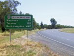
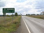
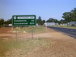
- Goondiwindi, Moonie, The Gums, Condamine, Miles, Wandoan, Taroom, Banana, Dululu and Westwood
Route Numbering:
- Current: A5
- Former: 39
- Multiplexed with: A2 60
- Road Authority Internal Classification:
- 26A (Westwood to Taroom) 1
- 26B (Taroom to Miles) 2
- 26C (Miles to Goondiwindi) 2
General Information:
National Route 39 headed north from just outside Goondiwindi through the remote western Darling Downs and cattle grazing regions past the intersection town of Moonie up to Miles where it met the Warrego Highway. Heading north from Miles, the same remote cattle country is prominent as the highway bypasses Wandoan to reach the pleasant town of Taroom. Once past the Isla Gorge, the highway enters the Callide Valley, bypassing Theodore before reaching the junction town of Banana. Originally the Leichhardt Highway terminated at Banana with NR39 following the Dawson Highway eastward towards Gladstone. However, with the extension of the Leichhardt Hwy north in 2000 to the small communities of Wowan and Dululu (where it touches the Burnett Hwy) to conclude near Westwood on the Capricorn Hwy. 3
- National Highway A2 (Warrego Hwy), for 700 m, Miles.
- State Route 60 (Dawson Hwy), for 600 m, Banana.
History:
- 2000: NR39 extended to the Capricorn Hwy. 3
- 2005: National Route replaced by A5 with the implementation of the Strategic Tourism Route Numbering scheme. 4
Click or tap here for the former alignment at Goondiwindi
Goondiwindi to Westwood
Westwood to Goondiwindi
2 QLD Government, Department of Main Roads, The State Road Network of Queensland Map, South Western District 4, August 2004.
3 Michael Greenslade.
4 Sam Laybutt (Ozroads).


