Statistics:
- Length:
- 15 km
- Termini:
- Eastern: Pacific Mwy (M1), Loganholme
- Western: Gateway Mwy (Metroad 4) and Logan Mwy (Metroad 4), Drewvale
- Suburbs, Towns & Localities Along Route:
- Drewvale, Berrinba, Kingston, Loganlea, Meadowbrook, Tanah Merah and Loganholme
Route Numbering:
- Current: M6
- Former: 4 6 40
- Road Authority Internal Classification: 1
- 210A
General Information:
Metroad 6, known as Logan Motorway, started life as Logan Arterial Road, a super-2 expressway road that was progressively upgraded to a motorway standard route that passed through the City of Logan local government area, south of Brisbane.
The route featured 2 lanes in each direction, with central divider, and electronic tolling points at Meadowbrook, which replaced traditional toll booths.
History:
- 1 October 1987: Construction commences on Logan Motorway. 2
- 13 December 1988: Logan Motorway officially opened, with a toll-free period for one week after its opening. 2
- 1997: Logan Motorway upgraded to two lanes in each direction. 2
- March 2007: Opening of upgraded Paradise Road interchange by the then Premier Peter Beattie and Minister for Transport and Main Roads, Paul Lucas. 3
- June 2009: Upgraded interchange ramps for access to Loganlea Road at Meadowbrook opened to traffic. 4
- July 2009: Cashless tolling introduced on the motorway with the completion of tolling gantries at Meadowbrook. 5
- January 2016: Metroad 6 replaced by M6.
Click or tap here for the former alignment between Drewvale and Loganholme
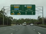
Intersection Directional Sign:
ID sign at the interchange with Logan Mwy (M2), Logan Mwy (Metroad 6) and Gateway Mwy (M2) at Drewvale, April 2012.
Image © Paul Rands
Gateway Motorway:
Gateway Mwy (M2) overpass at Drewvale, April 2012.
Image © Paul Rands
Advance Directional Sign:
AD sign at Drewvale for Wembley Rd (SR50) interchange, April 2012.
Image © Paul Rands
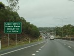
Advance Directional Sign:
AD sign at Drewvale for Wembley Rd (SR50) interchange, April 2012. Click or tap here for a photo of this location by Paul Rands from March 2006, featuring a freeway green sign.
Image © Paul Rands

Wembley Road Interchange:
Freeway green ID sign at the Wembley Rd (SR50) interchange at Drewvale, October 2004.
Image © Michael Greenslade
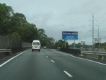
Third Avenue:
Logan Mwy (Metroad 6) at Third Av bridge in Kingston, April 2012.
Image © Paul Rands
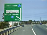
Advance Directional Sign:
AD sign at Kingston approaching the Jutland St interchange, October 2004. The sign should be prefixed with 'To' for SR95. The Metroad 6 shield is also the wrong colour, and SR95 in this area is named Kingston Rd.
Image © Michael Greenslade
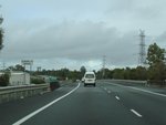
Eurora Street:
Logan Mwy (Metroad 6) as it passes over Eurora St, April 2012.
Image © Paul Rands
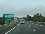
Advance Directional Sign:
AD sign at Kingston approaching the Jutland St interchange, April 2012. The sign should be prefixed with 'To' for SR95. SR95 in this area is named Kingston Rd.
Image © Paul Rands
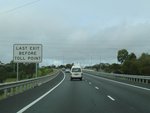
Toll Sign:
Sign at Kingston indicating Jutland St interchange is the last chance to exit before passing through the toll point, April 2012.
Image © Paul Rands
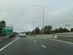
Kingston Road & Jutland Street interchange:
Logan Mwy (Metroad 6) as it crosses Kingston Rd (SR95) and approaches Jutland St interchange, April 2012.
Image © Paul Rands
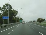
Toll Sign:
Sign indicating distance to electronic toll point, April 2012.
Image © Paul Rands
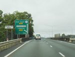
Advance Directional Sign:
Logan Mwy (Metroad 6) as it crosses Railway Pde and also AD sign at Kingston for University Dr interchange which connects with Loganlea Rd, April 2012.
Image © Paul Rands
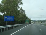
Supplemental Advance Directional Sign:
Logan Mwy (Metroad 6) as it crosses Railway Pde and also supplemental AD sign at Meadowbrook for University Dr interchange, which connects with Loganlea Rd, April 2012.
Image © Paul Rands
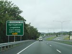
Advance Directional Sign:
Logan Mwy (Metroad 6) as it crosses Railway Pde and also AD sign at Meadowbrook for University Dr interchange, which connects with Loganlea Rd, April 2012.
Image © Paul Rands
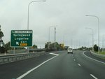
University Drive Interchange:
Logan Mwy (Metroad 6) at the University Dr interchange at Meadowbrook, April 2012. Click or tap here for a photo of this location by Paul Rands from March 2006, featuring a freeway green sign.
Image © Paul Rands
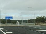
Toll Sign:
Sign indicating distance to electronic toll point, April 2012.
Image © Paul Rands

Advance Directional Sign:
AD sign at Meadowbrook approaching Drews Rd which connects to Pacific Mwy (Metroad 1) and the interchange with Pacific Mwy (M1), October 2004.
Image © Michael Greenslade

intersection Directional Sign:
ID sign assembly at the interchange with Drews Rd and Pacific Mwy (M1) at Meadowbrook, October 2004.
Image © Michael Greenslade

M1 / Metroad 6 interchange:
Southbound as you leave the Pacific Motorway (M1) (Exit 31) at Loganholme, March 2006.
Image © Paul Rands

Burchill Street:
Start of the Logan Motorway at Loganholme. Burchill Street offers access back onto the Pacific Motorway and also a section of the Pacific Highway that acts as a service road, March 2006.
Image © Paul Rands

Advance Directional Sign:
AD sign at Loganholme approaching Clarks Rd and access to Pacific Mwy (M1) northbound, March 2006.
Image © Paul Rands

Advance Directional Sign:
AD sign at Loganholme approaching Clarks Rd and access to Pacific Mwy (M1) northbound, March 2006.
Image © Paul Rands
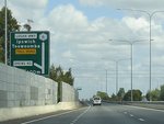
Advance Directional Sign:
AD sign approaching Drews Road interchange - the first exit after the Pacific Motorway interchange, westbound at Tanah Merah, March 2006.
Image © Paul Rands
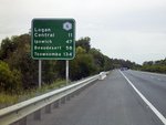
Distance Sign:
Westbound RD at Tanah Merah, after the Drews Road interchange, March 2003.
Image © Michael Greenslade
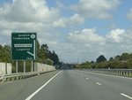
Advance Directional Sign:
AD sign approaching the Loganlea Road interchange at Meadowbrook, March 2006.
Image © Paul Rands
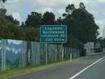
Freeway Green Advance Directional Sign:
Freeway green AD sign from the 1980s approaching the Loganlea Road interchange at Meadowbrook, March 2006.
Image © Paul Rands
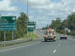
Distance Sign:
Westbound distance sign (partial freeway green) after the Loganlea Road interchange at Meadowbrook, March 2006.
Image © Paul Rands

Freeway Green Advance Directional Sign:
Freeway Green AD sign for the interchange with Station Road. Westbound at Loganlea, March 2003. Sign should be prefixed with 'To' Kingston Rd and also should have SR95 shield. The road is not named Kingston-Beenleigh Rd in this area.
Image © Michael Greenslade
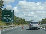
Advance Directional Sign:
AD sign for the Wembley Road (SR50) interchange at Berrinba, March 2006.
Image © Paul Rands
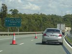
Freeway Green Advance Directional Sign:
Freeway green AD sign for the Wembley Road (SR50) interchange at Berrinba, March 2006.
Image © Paul Rands
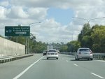
Wembley Road Interchange:
Westbound at the interchange with SR50 at Berrinba, March 2006.
Image © Paul Rands
1 QLD Government, Department of Transport and Main Roads.
2 Queensland Motorways, About Us, History, Logan Motorway.
3 QLD Government, Ministerial Media Statements, Paradise Found - Ahead of Time and Under Budget, 11 March 2007.
4 QLD Government, Ministerial Media Statements, Free-flowing Tolling Takes Shape at Stapylton Road Interchange, 29 May 2009.
5 The Courier Mail, Gateway Motorway e-tolls drive users away, 07 September 2009.


