Road Photos & Information: Queensland
South East Freeway and Riverside Expressway (F3) (Decommissioned)
Statistics:
- Length:
- 21 km
- Termini:
- Northern: Coronation Dr (SR33), Brisbane
- Southern: Pacific Hwy (NR1), Springwood
- Suburbs, Towns & Localities Along Route:
- Springwood, Underwood, Rochedale South, Rochedale, Eight Mile Plains, Macgregor, Upper Mount Gravatt, Mount Gravatt, Nathan, Holland Park West, Tarragindi, Greenslopes, Woolloongabba, South Brisbane and Brisbane
Route Numbering:
- Current: M3
- Former: 3 F-3 1
- Road Authority Internal Classification: 1
- U12A (South East Arterial Route)
General Information:
Today' Pacific Motorway once had 2 names, the bridges and interchanges in the Brisbane CBD were called the Riverside Expressway and the freeway south of the CBD was known as the South East Freeway. The South East Freeway and Riverside Expressway were two of the early projects to be completed from the Wilbur Smith "Brisbane Transportation Study", which was published in 1965 and made recommendations covering sixteen years to 1981. 2
The Captain Cook Bridge, which connects the South East Freeway and Riverside Expressway, is the third crossing of the Brisbane River. It crosses at the South Brisbane Reach of the river, and links Gardens Point to Woolloongabba. It carries four lanes of traffic in either direction.
History:
- 1965: American consultant Wilbur Smith, recommended an extensive freeway system for Brisbane (as part of the Brisbane Transportation Study), with the first section of the South East Freeway opening in 1970s. 3
- 1966: The Coordinator-General's Department commenced the design of the Riverside Expressway and the Captain Cook Bridge. 4
- 20 August 1969: The construction contract for the Riverside Expressway was let to Messrs. McDougall-Ireland Pty Ltd. 4
- November 1972: The Captain Cook Bridge and the first stage of the Southeast Freeway were opened to traffic. 5 6
- 1975: Work on the Southeast Freeway to extend it to Holland Park. 7
- 22 July 1976: Riverside Expressway opened to traffic. 8
- 1976: First sections of the South East Freeway completed. 9
- 1977: The South East Freeway reached Marshall Road. 2
- 1980: The South East Freeway reached Klumpp Rd & Mains Road. 2
- 1982: The South East Freeway reached Logan Road. 2
- 1985: The South East Freeway reached the Pacific Highway at Springwood. 2
- March 1996: The Queensland Government announced its intention to widen the South East Freeway to eight lanes between the Brisbane central business district and the Gold Coast. In the Brisbane City and Logan City areas, the Transport Planning (south-east Queensland) Branch of Queensland Transport proposed that the additional lanes should be provided as busway lanes and transit lanes. 10
- 13 September 2000: The first section of busway between the CBD and Woolloongabba was opened to services, which coincided with the first match in the Sydney 2000 Olympic Games Football Tournament at Woolloongabba. 10
- 30 April 2001: The second section of busway between Woolloongabba and Eight Mile Plains opened. 10
- 2009: Metroad 3 decommissioned, route renumbered M3 for motorway standard / limited access sections and A3 for suburban arterial road sections. 11
Freeway Green and Black Intersection Directional Sign:
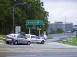
[SIGN 1] ID sign on Logan Rd (SR95 and former NR1) at the interchange with Pacific Mwy (former South East Fwy) at Eight Mile Plains. The Metroad 3 coverplate is hiding an F3 shield, and the blank plate beside it is covering an ALT-NR1 shield. January 2005.
Image © Michael Greenslade
Advance Directional Sign:
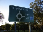
[SIGN 9] AD sign designed by Brisbane City Council as a replacement for an older sign, on Ekibin Rd East at Annerly approaching Lewisham St. Note the F3 shield, this is in error, as the F3 route number was decommissioned long before this sign was made. March 2006.
Image © Paul Rands
Advance Directional Sign:
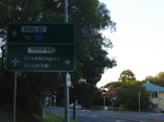
[SIGN 10] AD sign designed by Brisbane City Council as a replacement for an older sign, northbound on Lewisham Street at Greenslopes approaching Ridge Street and Earl Street. Note the F3 shield, this is in error, as the F3 route number was decommissioned long before this sign was made. March 2006.
Image © Paul Rands
Advance Directional Sign:
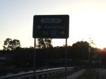
[SIGN 11] AD sign designed by Brisbane City Council as a replacement for an older sign, westbound on Ridge St at Greenslopes approaching Lewisham St and Earl St. Note the F3 shield, this is in error, as the F3 route number was decommissioned long before this sign was made. March 2006.
Image © Paul Rands
2 QLD Government, Queensland Roads, March 2009.
3 The 200 km City Web Site.
4 QLD Government, Queensland Roads, Edition No. 4, Sept 07.
5 Redcliffe City Library
6 QLD Government, Queensland State Archives, 1972 Cabinet Minutes.
7 QLD Government, Queensland State Archives, 1975 Cabinet Minutes Historian's Report.
8 QLD Government, Queensland State Archives, 1976 Cabinet Minutes.
9 Brisbane City Council Annual Report 06-07.
10 Busway Website History Web Page.
11 Michael Greenslade.
