| Arnhem Highway (State Route 36) (Decommissioned) |
Statistics:
Route Numbering:
General Information:
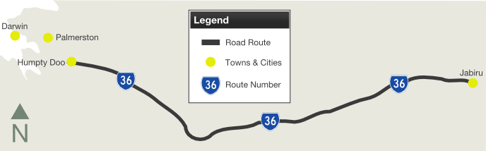
SR36 was a significant link between the Stuart Highway, communities in the Arnhem Land region, Kakadu National Park and mining areas around Jabiru.
The road is undivided rural highway standard and passes through mostly bushland and conservation areas.
History:
| Preview: | Description: |
 |
Advance Directional Sign: Eastbound AD sign in the Middle Point area approaching Anzac Parade. September 2008. Image © Kate Pilling |
 |
Intersection Directional Sign: ID sign with incorrect NH36 shield facing traffic from Jim Jim Road, east of Mt Bundey. September 2008. Image © Kate Pilling |
 |
Tourism AD Sign: Advance directional sign as you enter Kakadu National Park west of Jabiru, September 2008. Image © Kate Pilling |
 |
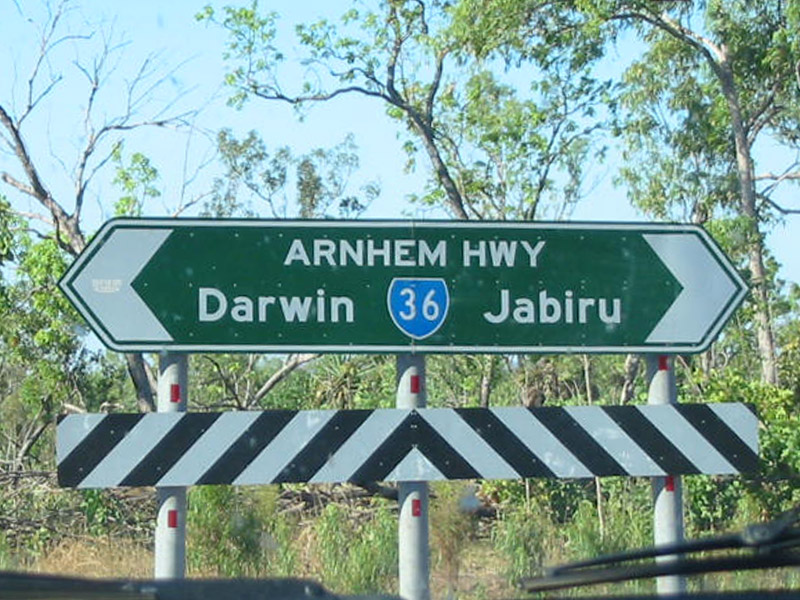
Advance Directional Sign: Eastbound alphanumeric AD sign approaching Oen Pilli Road near Jabiru, September 2008. Image © Kate Pilling |
 |
Intersection Directional Sign: ID sign facing Kakadu Hwy (SR21) traffic at Jabiru. September 2008. Image © Kate Pilling |
1 Litchfield Shire Council
2 Northern Territory Treasury
Last updated: 14-Feb-2019 22:08
This site © Paul Rands. All rights reserved. Some portions © (copyright) by their respective and credited owners. Permission must be obtained before using any images from this site. For details, please email by clicking here.