|
|
|
|
|
 |
Castlereagh Highway (State Route 86) - Marrangaroo to Capertee (Decommissioned) |
Statistics:
Route Numbering:
General Information:
Castlereagh Highway is a significant highway link in the New South Wales road network, linking towns west of the Great Dividing Range (such as Lithgow) to the central west of the state and eventually to Queensland. The State Route 86 segment, passes through rural and populated areas, linking Lithgow with the agricultural centre of Gilgandra, north of Dubbo (via NR34 / NH39).
The Castlereagh Highway is predominantly a 2-lane road, with sealed shoulders and occasional auxiliary lanes provided for overtaking. The speed limit is generally 100km/h, with lower speed limits in place in built up areas. Between Mudgee and Gulgong, the 2002 Annual Average Daily Traffic volume (AADT) was around 3,000 axle pairs. 2
History:
| Marrangaroo to Capertee | Capertee to Marangaroo | |||
| Preview: | Description: | Preview: | Description: | |
 |
Great Western Highway Interchange: Southern terminus of SR86: Great Western Hwy (NR32) interchange at Marrangaroo, November 2011. Image © Paul Rands |
 |
Entering Ben Bullen : Castlereagh Hwy (SR86) as it enters the village of Ben Bullen, April 2012. Image © Paul Rands |
|
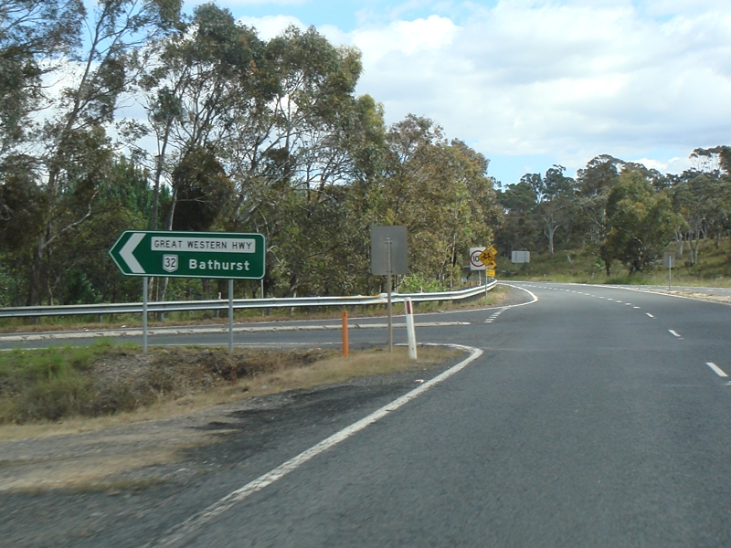 |
Great Western Highway Interchange: Southern terminus of SR86: Great Western Hwy (NR32) interchange at Marrangaroo, November 2011. Image © Paul Rands |
 |
Warning Signs : Special warning signs approaching the level crossing and junction with Quarry Rd at Ben Bullen, April 2012. Image © Paul Rands |
|
 |
Reassurance Directional Sign: Distance sign at Wallerawang, November 2011. Note the very old concrete surface. Image © Paul Rands |
 |
Quarry Road : Corner of Castlereagh Hwy (SR86) and Quarry Rd at Ben Bullen, approaching the railway level crossing, April 2012. Image © Paul Rands |
|
 |
Approaching Springvale Colliery: Freight railway and unusual warning signs approaching the entrace to Springvale Colliery at Wallerawang, November 2011. Image © Paul Rands |
 |
Level Crossing : Castlereagh Hwy (SR86) at Ben Bullen crossing over the railway, April 2012. Image © Paul Rands |
|
 |
Advance Directional Sign: AD sign approaching Main St and Wolgan Rd at Wallerawang, November 2011. Image © Paul Rands |
 |
Intersection Directional Sign : ID sign acting as a reassurance sign after the railway level crossing at Ben Bullen, April 2012. Image © Paul Rands |
|
 |
Intersection Directional Sign: ID sign assembly at the Main St & Wolgan Rd junction in Wallerawang, November 2011. Image © Paul Rands |
 |
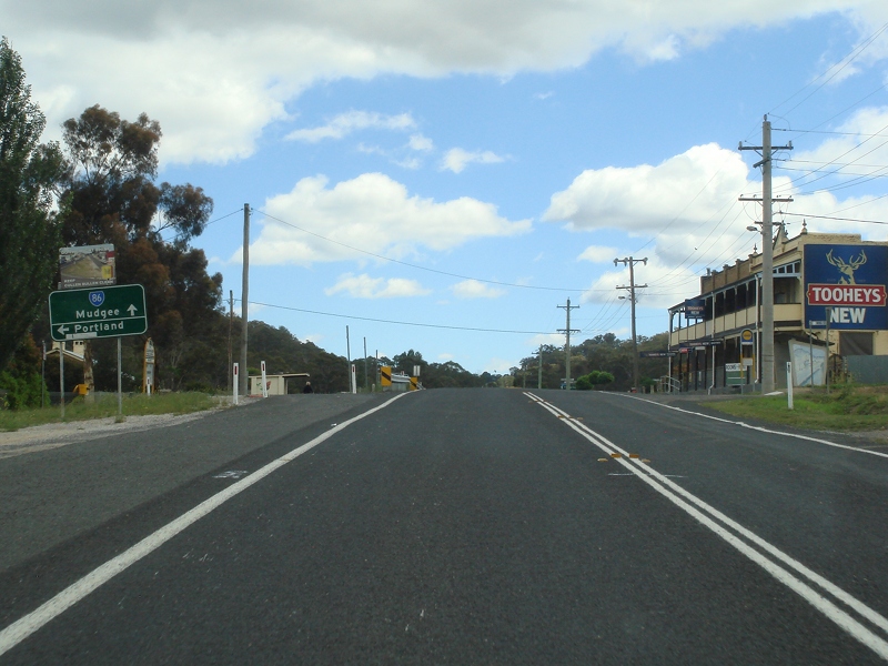
Entering Cullen Bullen : Castlereagh Hwy (SR86) as it enters the town of Cullen Bullen, April 2012. Image © Paul Rands |
|
 |
Intersection Directional Sign: ID sign assembly at the Main St & Wolgan Rd junction in Wallerawang, November 2011. Image © Paul Rands |
 |
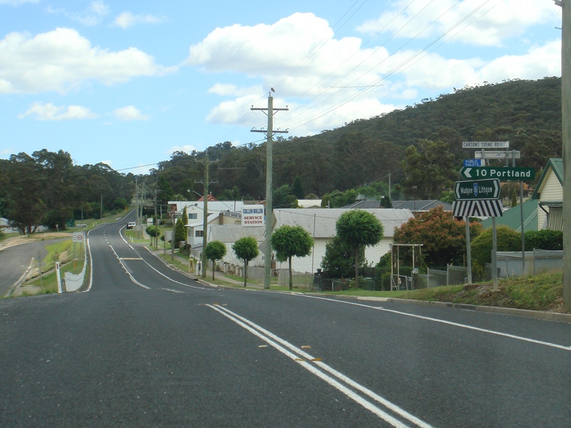
Advance Directional Sign : AD sign at Cullen Bullen, approaching Carsons Siding Rd, April 2012. Image © Paul Rands |
|
 |
Intersection Directional Sign: ID sign assembly at the Ian Holt Dr junction in Wallerawang, November 2011. Image © Paul Rands |
 |
Carsons Siding Road : Corner of Castlereagh Hwy (SR86) and Carsons Siding Rd in Cullen Bullen, April 2012. Image © Paul Rands |
|
 |
Cox's River: Castlereagh Hwy (SR86) as it crosses Cox's River at Wallerawang, November 2011. Image © Paul Rands |
 |
Reassurance Directional Sign : Distance on the outskirts of Cullen Bullen, April 2012. Image © Paul Rands |
|
 |
Distance Sign: RD sign leaving Wallerawang, November 2011. Image © Paul Rands |
 |
Cullen Bullen: Typical road conditions outside the Cullen Bullen township, April 2012. Image © Paul Rands |
|
 |
Blackmans Flat: Castlereagh Hwy passing through Blackmans Flat, November 2011. Image © Paul Rands |
 |
Advance Directional Sign : AD sign at Blackmans Flat, approaching Boulder Rd, April 2012. Image © Paul Rands |
|
 |
Advance Directional Sign: AD sign approaching Boulder Rd at Blackmans Flat, November 2011. Image © Paul Rands |
 |
Boulder Road : Corner of Castlereagh Hwy (SR86) and Boulder Rd at Blackmans Flat, April 2012. Image © Paul Rands |
|
 |
Intersection Directional Sign: ID sign at Boulder Rd in Blackmans Flat, November 2011. Image © Paul Rands |
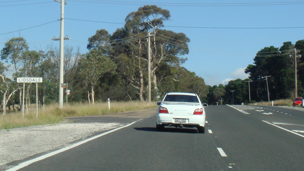 |
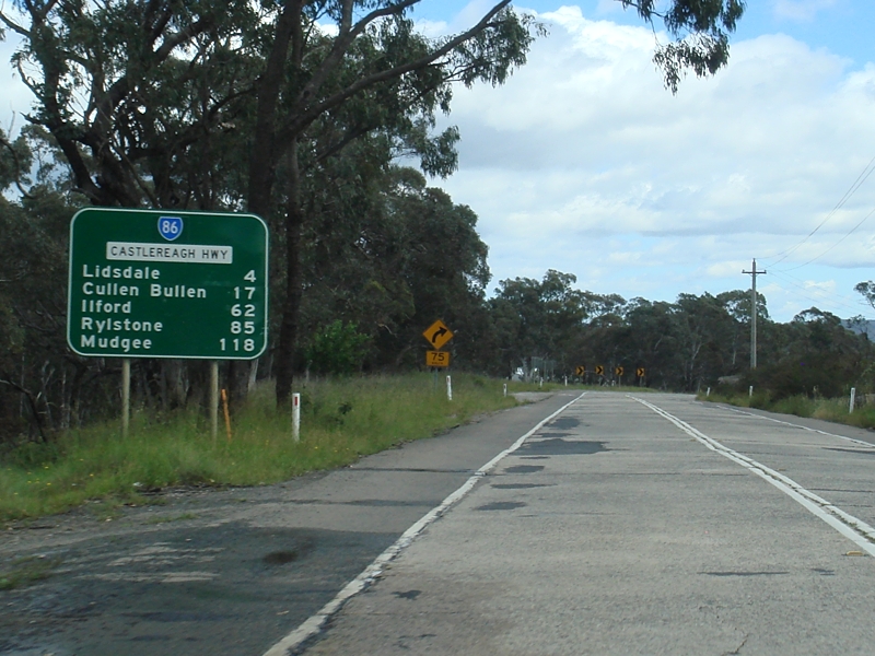
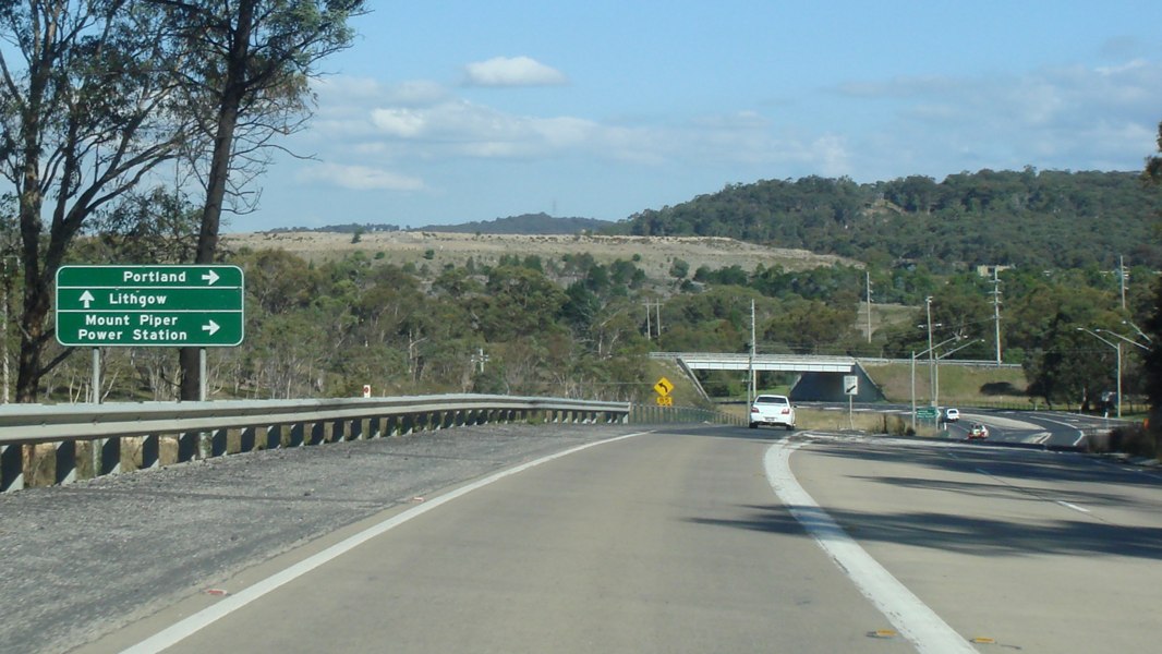
Entering Lidsdale : Castlereagh Hwy (SR86) as it enters the town of Lidsdale, April 2012. Image © Paul Rands |
|
 |
Intersection Directional Sign: ID sign at Boulder Rd in Blackmans Flat, November 2011. Image © Paul Rands |
 |
Coxs River : Castlereagh Hwy (SR86) as it crosses Coxs River at Lidsdale, April 2012. Image © Paul Rands |
|
 |
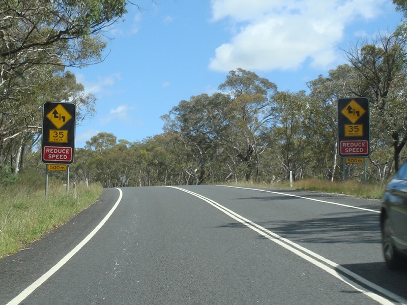
Steep Descent: Sign warning of steep descent down the range near Cullen Bullen, November 2011. Image © Paul Rands |
 |
Alphanumeric Advance Directional Sign: Alphanumeric AD sign approaching Ian Holt Dr at Lidsdale, April 2012. Image © Paul Rands |
|
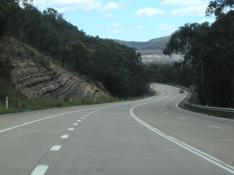 |
Cullen Bullen: Castlereagh Hwy (SR86) making its way down the range at Cullen Bullen, November 2011. Image © Paul Rands |
 |
ian Holt Drive : Corner of Castlereagh Hwy (SR86) and Ian Holt Dr at Lidsdale, April 2012. Image © Paul Rands |
|
 |
Entering Cullen Bullen: Castlereagh Hwy (SR86) entering the town of Cullen Bullen, November 2011. Image © Paul Rands |
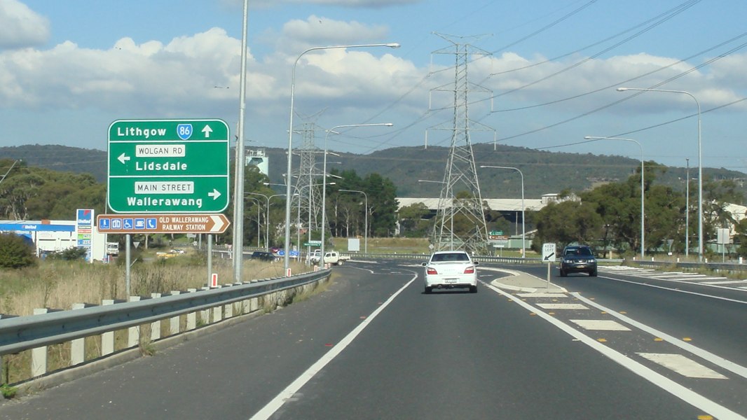 |
Advance Directional Sign : AD sign at Wallerawang approaching Wolgan Rd and Main St, April 2012. Image © Paul Rands |
|
 |
Advance Directional Sign: AD sign approaching Carsons Siding Rd at Cullen Bullen, November 2011. Image © Paul Rands |
 |
Main Street : Corner of Castlereagh Hwy (SR86) and Main St in Wallerawang, April 2012. Image © Paul Rands |
|
 |
Carsons Siding Road: Castlereagh Hwy (SR86) at Carsons Siding Rd, Cullen Bullen, November 2011. Image © Paul Rands |
 |
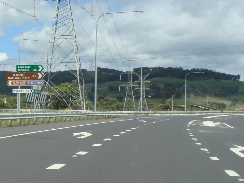
Wolgan road : Corner of Castlereagh Hwy (SR86) and Wolgan Rd in Wallerawang, April 2012. Image © Paul Rands |
|
 |
Cullen Bullen: Castlereagh Hwy passing through Cullen Bullen town centre, November 2011. Image © Paul Rands |
 |
Reassurance Directional Sign : Distance sign at Wallerawang, April 2012. Image © Paul Rands |
|
 |
Distance Sign: RD sign leaving Cullen Bullen, November 2011. Image © Paul Rands |
 |
Main Western Railway: Castlereagh Hwy (SR86) as it passes under the Main Western Railway Line at Wallerawang, April 2012. Image © Paul Rands |
|
 |
Entering Ben Bullen: Castlereagh Hwy (SR86) entering the village of Ben Bullen, November 2011. Image © Paul Rands |
 |
Advance Directional Sign : AD sign at Marrangaroo approaching the Great Western Hwy (NR32) interchange, April 2012. Image © Paul Rands |
|
 |
Warning Signs: Warnings for reverse turn over the Ben Bullen railway level crossing, November 2011. Image © Paul Rands |
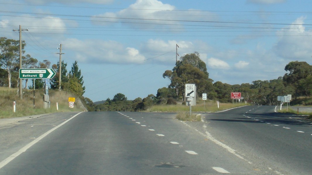 |
Great Western Highway : Castlereagh Hwy (SR86) at the Great Western Hwy (NR32) interchange at Marrangaroo, April 2012. Image © Paul Rands |
|
 |
Warning Signs: Warnings for reverse turn over the Ben Bullen railway level crossing, November 2011. Image © Paul Rands |
|||
 |
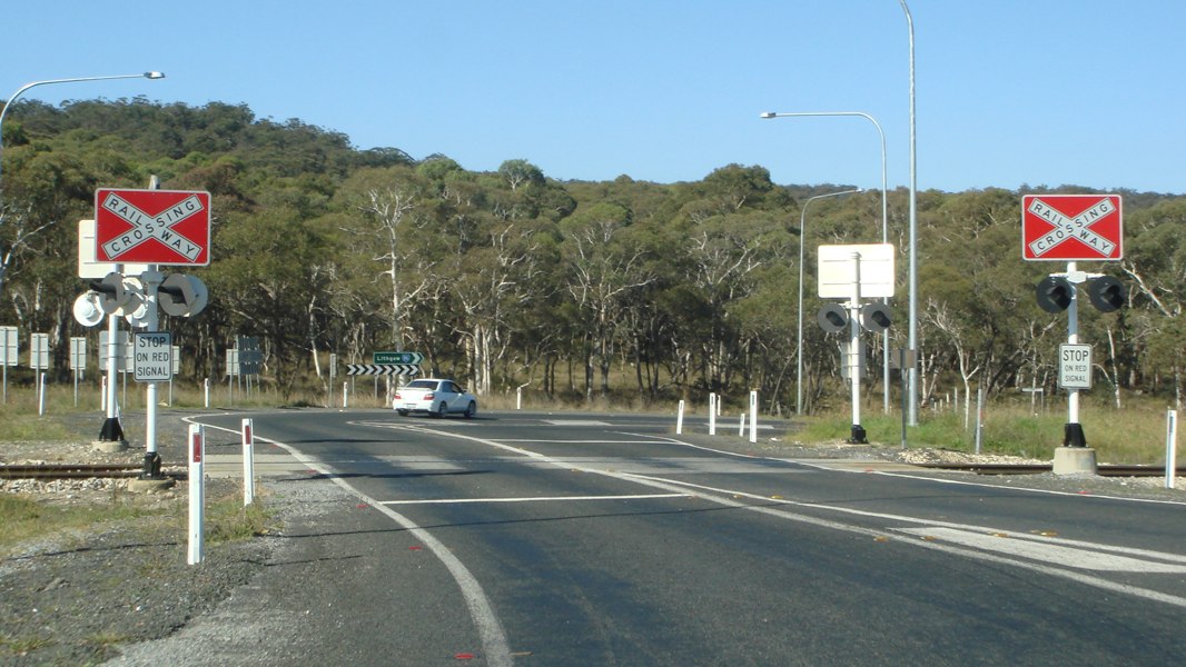
Approaching Ben Bullen Level Crossing: Castlereagh Hwy (SR86) approaching the Ben Bullen railway crossing, November 2011. Image © Paul Rands |
|||
 |
Approaching Ben Bullen Level Crossing: Castlereagh Hwy (SR86) approaching the Ben Bullen railway crossing, November 2011. Image © Paul Rands |
|||
 |
Approaching Ben Bullen Level Crossing: Castlereagh Hwy (SR86) approaching the Ben Bullen railway crossing, November 2011. Image © Paul Rands |
|||
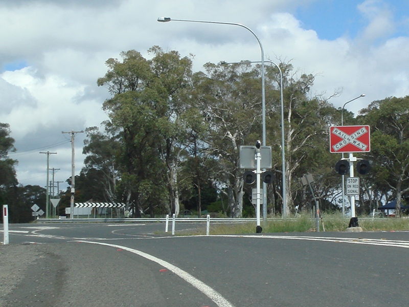 |
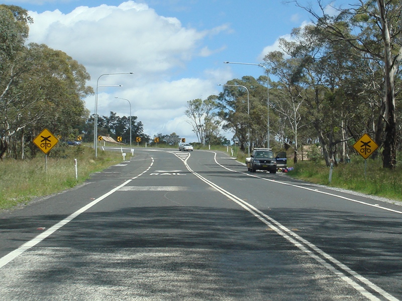
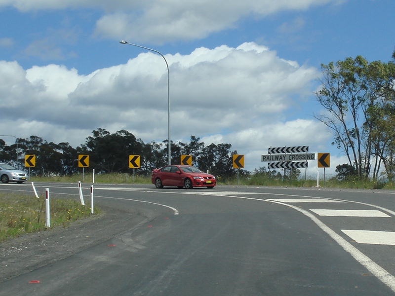
Railway Crossing & Quarry Road Intersection: Castlereagh Hwy (SR86) as it crosses the railway level crossing at Ben Bullen, with the Quarry Rd junction in the distance, November 2011. Image © Paul Rands |
|||
 |
Ben Bullen: Castlereagh Hwy (SR86) as it passes through the Ben Bullen area, November 2011. Image © Paul Rands |
|||
 |
Cherry Tree Hill: Castlereagh Hwy (SR86) as it makes its way over Cherry Tree Hill at Ben Bullen, November 2011. Image © Paul Rands |
|||
| Click here for the continuation of State Route 86 between Capertee and Mudgee | ||||
1 Roads & Traffic Authority
2 NSW Department of Planning, taken from the Sinclair Knight Merz report on the Moolarben Coal Project
Last updated: 27-Oct-2018 21:02
This site © Paul Rands. All rights reserved. Some portions © (copyright) by their respective and credited owners. Permission must be obtained before using any images from this site. For details, please email by clicking here.