|
|
|
|
|
 |
Cobb Highway (National Route 75) (Decommissioned) |
Statistics:
Route Numbering:


General Information:
The Cobb Highway commences at Moama on the Murray River and continues for in a northerly direction through Mathoura, Deniliquin, Hay, Booligal, Mossgiel and Ivanhoe, to a junction with the Barrier Highway (NR32 / State Highway No. 8) a few kilometres south of Wilcannia. At Deniliquin the Highway connects with the Riverina Highway (NR58 / State Highway No. 20) and at Hay it intersects the Sturt Highway (NH20 / State Highway No.14) and connects with the Mid-Western Highway (NR24 / State Highway No. 6). 1
It follows a route at one time used by coaches of Cobb & Co., the great pioneering firm whose coaching activities which commenced in 1853 and amongst their many services operated a route through the Riverina to Wilcannia and Broken Hill. 1
10 km north of Deniliquin, there is a survey tree, which is a large eucalypt. It features a surveyors' benchmark, which comprises of a chiselled "V" section lettering "T" and a broad arrow on a very weathered scar surface. A section at the base of the tree has also been carved away though the galvanised nail that would originally have been in place is no longer present. Benchmarks established by the Main Roads Board, the authority in place between 1925 and 1932 typically featured the lettering "MRB BM" and a number relating to the location of the mark within the sequence. That the benchmark was limited to a "T" mark therefore is indicative of it having been placed after this period, when the management of roads was passed on to the Department of Main Roads (DMR). 1
The NR24 multiplex is in Hay only and travels from the Sturt Hwy roundabout to the junction of Mid Western Hwy (Murray St) and is 2 km in length.
History:

| Vic Border to Wilcannia | Wilcannia to Vic Border | |||
| Preview: | Description: | Preview: | Description: | |
 |
Advance Directional Sign : AD sign at Deniliquin on Hardinge St, approaching Cobb Hwy (NR75) and Ochertyre St, August 2013. Image © Peter Renshaw |
 |
Intersection Directional Sign: ID sign at the junction of Barrier Hwy (NR32) and Cobb Hwy (NR75) at Wilcannia, June 2012. Image © Peter Renshaw |
|
 |
Advance Directional Sign : AD sign on Ochertye St in Deniliquin, approaching Cobb Hwy (NR75) and Hardinge St, August 2013. Image © Peter Renshaw |
 |
Intersection Directional Sign: ID sign at the junction of Barrier Hwy (NR32) and Cobb Hwy (NR75) at Wilcannia, June 2012. Image © Peter Renshaw |
|
 |
Advance Directional Sign : AD sign on Riverina Hwy (NR58) in Deniliquin, approaching Cobb Hwy (NR75) October 2004. Image © Jamie Scuglia |
 |
Reassurance Directional Sign : Distance sign at Wilcannia, December 2003. Image © Michael Greenslade |
|
 |
Advance Directional Sign : AD sign at Pretty Pine, approaching Cobb Hwy (NR75) and Moulamein Rd, August 2013. Image © Peter Renshaw |
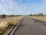 |
Black Kilometre Plate: Early style black kilometre plate dating back to the introduction of metric measurements in 1974, Wilcannia, June 2012. Image © Peter Renshaw |
|
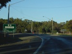 |
Distance Sign: RD sign after the Sturt Hwy (NH20) roundabout at South Hay. December 2007. Image © Paul Rands |
 |
Intersection Directional Sign: ID sign assembly at Terawynia Rd at Wilcannia, June 2012. Image © Peter Renshaw |
|
 |
Murrumbidgee River: Cobb Hwy as it crosses the Murrumbidgee River in South Hay. December 2007. Image © Paul Rands |
 |
Intersection Directional Sign: ID sign assembly at Baden Park Rd at Gypsum Palace, June 2012. Image © Peter Renshaw |
|
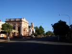 |
Lachlan Street Hay: Cobb Hwy in the Hay CBD. December 2007. Image © Paul Rands |
 |
Intersection Directional Sign: ID sign assembly at Tasman Rd in Ivanhoe, June 2012. Image © Peter Renshaw |
|
 |
Advance Directional Sign: AD sign near Cadell Street in Hay, December 2007. Image © Paul Rands |
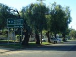 |
Advance Directional Sign: AD sign for the Cadell St intersection, in Hay. Note the incorrect SR75 shield. December 2007. Image © Paul Rands |
|
 |
Advance Directional Sign: Northbound advance directional sign (with incorrect SR24 shield) approaching the Murray Street / Mid Western Highway intersection in Hay, December 2007. Image © Paul Rands |
 |
Supplemental AD Sign: Supplementary advance directional sign on Cobb Hwy approaching the Sturt Hwy roundabout at South Hay, December 2007. Image © Paul Rands |
|
 |
Alphanumeric Distance Sign: Northbound distance signage after the Mid Western Hwy / Murray St intersection as you leave the town of Hay, January 2004. Note the missing route shield. Image © Michael Greenslade |
 |
Advance Directional Sign: AD sign for the Sturt Highway intersection, southbound at South Hay. December 2007. Image © Paul Rands |
|
 |
Intersection Directional Sign: ID sign at the junction of Barrier Hwy (NR32) and Cobb Hwy (NR75) at Wilcannia, December 2003. Image © Michael Greenslade |
 |
Intersection Directional Sign: ID sign on the eastbound leg of the Sturt Hwy (NH20) / Cobb Hwy (NR75) roundabout in South Hay, December 2007. Image © Paul Rands |
|
 |
Reassurance Directional Sign : Distance sign at South Hay, January 2004. Image © Michael Greenslade |
|||
 |
Reassurance Directional Sign : Distance sign at Pretty Pine, August 2013. Note the incorrect route shield. Image © Peter Renshaw |
|||
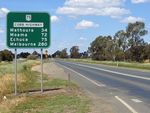 |
Reassurance Directional Sign : Distance sign at Deniliquin, October 2004. Image © Jamie Scuglia |
|||
| Click here for the continuation of this route as Northern Highway (B75) in Victoria | ||||
1 Roads & Traffic Authority
Last updated: 11-Sep-2020 20:29
This site © Paul Rands. All rights reserved. Some portions © (copyright) by their respective and credited owners. Permission must be obtained before using any images from this site. For details, please email by clicking here.