|
|
|
|
|

|
Federal Highway (National Highway 23) (Decommissioned) |
Statistics:
Route Numbering:


General Information:
The Federal Highway is one of two major connectors from Canberra to the Hume Highway, which links Sydney with Melbourne. The entire length of the Federal Highway is dual carriageway. The route forms the Remembrance Driveway which honours war veterans, click here for the Remembrance Driveway web site. 2
More than 12,000 vehicles use the Federal Highway each day, of which over 15 per cent are commercial vehicles.
History:
Click here for photos of the former alignment from Yarra to ACT Border.

| Hume Highway to ACT Border | ACT Border to Hume Highway | |||
| Preview: | Description: | Preview: | Description: | |
 |
ID Signs: Southbound directional sign on the Hume Highway approaching the Federal Highway at Yarra, September 2010. Click here, here and here for photos of the old sign assemblies from July 2006 and December 2009. Image © Paul Rands |
 |
ACT / NSW Border: Masonry border crossing sign at Ginns Gap at Sutton, December 2009. Image © Paul Rands |
|
 |
Distance Sign: The first RD sign on NH23, as you head south from the Hume Highway interchange at Wollogorang, September 2010. Click here for a photo of the old sign from January 2010. Image © Paul Rands |
 |
Services Sign: Services sign at Sutton for the Federal Hwy Service Rd, December 2009. Image © Paul Rands |
|
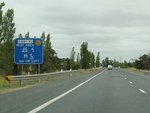 |
Services Sign: Services orientated advance directional sign for the Kibby VC rest area, Yarra, January 2010. Image © Paul Rands |
 |
Welcome to New South Wales: Sign welcoming motorists to NSW, Sutton, December 2009. Image © Paul Rands |
|
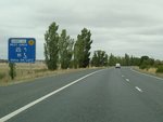 |
Services Sign: Services orientated advance directional sign for the Kibby VC rest area, Yarra, January 2010. Image © Paul Rands |
 |
Distance Sign: Tourist themed reassurance directional sign at Sutton, June 2013. Image © Paul Rands |
|
 |
Kibby VC Rest Area: Federal Hwy (NH23) at the junction with Kibby VC rest area at Yarra, January 2010. Image © Paul Rands |
 |
Advance Directional Sign: AD sign at Sutton approaching Sutton Rd interchange, December 2009. Image © Paul Rands |
|
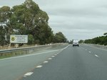 |
Remembrance Driveway: Sign indicating the Federal Hwy forms part of the Remembrance Driveway which commemorates Australia's War Heroes with a Living Memorial of those who served in the Australian Defence Forces in World War II and subsequent wars or conflicts. Click here for more information, January 2010. Image © Paul Rands |
 |
Supplemental Advance Directional Sign: Supplemental AD sign at Sutton approaching Sutton Rd interchange, December 2009. Image © Paul Rands |
|
 |
Approaching Thornford Road: Southbound at Wollogorang, approaching the at-grade intersection with Thornford Road, January 2010. Image © Paul Rands |
 |
Advance Directional Sign: AD sign at Sutton approaching Sutton Rd interchange, December 2009. Image © Paul Rands |
|
 |
Crossing the Great Dividing Range: Sign indicating the top of the Great Dividing Range at Wollogorang, January 2010. Image © Paul Rands |
 |
Sutton Road Interchange: Federal Hwy (NH23) at the Sutton Rd interchange at Sutton, December 2009. Image © Paul Rands |
|
 |
Entering Wollogorang: Southbound as the Federal Hwy enters Wollogorang, January 2010. Image © Paul Rands |
 |
Sutton Road Interchange: Federal Hwy (NH23) at the Sutton Rd interchange at Sutton, December 2009. Image © Paul Rands |
|
 |
Services Sign: Services orientated advance directional sign for the Edmonson VC rest area, Wollogorang, January 2010. Image © Paul Rands |
 |
Advance Directional Sign: AD sign at Sutton approaching Macs Reef Rd, December 2009. Image © Paul Rands |
|
 |
Services Sign: Services orientated advance directional sign for the Edmonson VC rest area, Wollogorang, January 2010. Image © Paul Rands |
 |
Macs Reef Road: Federal Hwy (NH23) at the junction with Macs Reef Rd in Sutton, December 2009. Image © Paul Rands |
|
 |
Edmonson VC Rest Area: As part of the Remembrance Driveway program, the rest areas along the Federal Hwy are named after Victoria Cross awards, such as this one at Wollogorang, January 2010. Image © Paul Rands |
 |
Distance Sign: RD sign at Sutton after the Macs Reef Rd junction, December 2009. Image © Paul Rands |
|
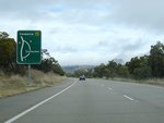 |
Supplemental AD Sign: Signage showing the bypassed town of Collector, July 2006. Image © Paul Rands |
 |
Yass River: Federal Hwy as it crosses Yass River at Sutton, December 2009. Image © Paul Rands |
|
 |
Services Sign: Typical services sign, southbound at Collector, July 2006. The fuel pictogram has since been coverplated. Image © Paul Rands |
 |
Remembrance Driveway: Sign indicating the Federal Hwy forms part of the Remembrance Driveway which commemorates Australia's War Heroes with a Living Memorial of those who served in the Australian Defence Forces in World War II and subsequent wars or conflicts. Bywong, December 2009. Image © Paul Rands |
|
 |
Advance Directional Sign: Southbound AD sign approaching the junction with Church Street at Collector, July 2006. Image © Paul Rands |
 |
Old Federal Highway & Donnolly Drive: Access road junction to Old Federal Hwy and Donnolly Dr at Bywong, December 2009. Image © Paul Rands |
|
 |
Intersection Directional Sign: Southbound ID sign at the junction with Church Street (Bredalbane Rd) at Collector, July 2006. Image © Paul Rands |
 |
Services Sign: Services sign at Bywong for Middleton VC Rest Area, December 2009. Image © Paul Rands |
|
 |
Bredalbane Road: Corner of Federal Hwy (NH23) and Bredalbane Rd at Collector, January 2010. Image © Paul Rands |
 |
Services Sign: Services sign at Bywong for Middleton VC Rest Area, December 2009. Image © Paul Rands |
|
 |
Currawang Road Intersection: Southbound at the junction Currawang Road, Collector, July 2006. Image © Paul Rands |
 |
Bungendore Road: Federal Hwy (NH23) at the junction with Bungendore Rd (TD8) at Bywong, December 2009. Image © Paul Rands |
|
 |
Advance Directional Sign: Southbound AD approaching the turn off to Collector-Gunning Road (old Federal Highway) and also Collector Creek (Flood Plain 1) at Collector, July 2006. Image © Paul Rands |
 |
Bungendore Road: Federal Hwy (NH23) at the junction with Bungendore Rd (TD8) at Bywong, December 2009. Image © Paul Rands |
|
 |
Intersection Directional Sign: ID sign at the junction with Collector-Gunning Road at Collector, July 2006. Image © Paul Rands |
 |
Middleton VC Rest Area: Federal Hwy (NH23) at the junction with Middleton VC Rest Area at Bywong, December 2009. Image © Paul Rands |
|
 |
Distance Sign: Southbound RD sign just after the intersection with Murray Street at Collector, January 2010. Image © Paul Rands |
 |
Shingle Hill Way: Federal Hwy (NH23) at the junction with Shingle Hill Way (formerly Bungendore Rd) at Bywong, December 2009. Image © Paul Rands |
|
 |
Entering the Lake George Area: Southbound past Lake George, July 2006. Image © Paul Rands |
 |
Services Sign: Services sign at Lake George for Anderson VC Rest Area, December 2009. Image © Paul Rands |
|
 |
Tourist Sign: AD sign for The Vineyards Dr (former Federal Highway) Lake George, January 2010. Image © Paul Rands |
 |
Services Sign: Services sign at Lake George for Anderson VC Rest Area, December 2009. Image © Paul Rands |
|
 |
The Vineyards Drive Junction: Southbound intersection with The Vineyards Dr, Lake George, January 2010. Image © Paul Rands |
 |
Anderson VC Rest Area / Hadlow Drive: Federal Hwy (NH23) overlooking Lake George at the junction with Hadlow Dr (former Federal Hwy) and the access point to Anderson VC Rest Area, December 2009. Image © Paul Rands |
|
 |
Services Sign: Services sign for the driver reviver at Wheatley VC rest area, Lake George, January 2010. Image © Paul Rands |
 |
Northbound view of Federal Hwy: Looking in a northerly direction towards the approach of Nerrin Nerrin Creek and Lake George at Bywong, July 2006. Image © Paul Rands |
|
 |
Rest Area AD Sign: Advance directional sign for the Badcoe Victoria Cross Rest Area alongside Lake George, July 2006. Image © Paul Rands |
 |
Rock Falls Sign: Sign displaying a phone number to report rock falls, Lake George, December 2009. Image © Paul Rands |
|
 |
Rest Area AD Sign: Advance directional sign for the Badcoe Victoria Cross Rest Area alongside Lake George, January 2010. Image © Paul Rands |
 |
Services Sign: Services sign at Lake George for Gurney VC Rest Area, December 2009. Image © Paul Rands |
|
 |
Badcoe VC Rest Area Junction: Southbound at the Badcoe Victoria Cross Rest Area alongside Lake George, July 2006. Image © Paul Rands |
 |
Services Sign: Services sign at Lake George for Gurney VC Rest Area, December 2009. Image © Paul Rands |
|
 |
Services Sign: Services sign for the Wheatley VC rest area, Lake George, January 2010. Image © Paul Rands |
 |
Advance Directional Sign: AD sign for The Vineyards Dr (former Federal Hwy) at Lake George, December 2009. Image © Paul Rands |
|
 |
Services Sign: Services sign for the Wheatley VC rest area, Lake George, January 2010. Image © Paul Rands |
 |
The Vineyards Drive / Gurney VC Rest Area: Federal Hwy at the junction with The Vineyards Dr and the access point to the Gurney VC Rest Area at Lake George, December 2009. Image © Paul Rands |
|
 |
Services Sign: Services sign for the driver reviver at Wheatley VC rest area, Lake George, January 2010. Image © Paul Rands |
 |
The Vineyards Drive / Gurney VC Rest Area: Federal Hwy at the junction with The Vineyards Dr and the access point to the Gurney VC Rest Area at Lake George, December 2009. Image © Paul Rands |
|
 |
Wheatley VC Rest Area Junction: Southbound at the Wheatley Victoria Cross Rest Area alongside Lake George, January 2010. Image © Paul Rands |
 |
Bypassed Town Sign: Bypassed town sign for Collector, December 2009. Image © Paul Rands |
|
 |
Lookout Services Sign: Sign for services available at the upcoming lookout and rest area on the southwest side of Lake George, July 2006. This sign has since been removed. Image © Paul Rands |
 |
Services Sign: Services sign for the town of Collector, December 2009. Image © Paul Rands |
|
 |
Advance Directional Sign: AD Sign approaching the Weereewaa Lookout over Lake George and Hadlow Dr (former Federal Hwy), Bywong, January 2010. Click here for a photo of the old sign from July 2006. Image © Paul Rands |
 |
Advance Directional Sign: AD sign at Collector approaching Collector-Gunning Rd (former Federal Hwy), June 2013. Click here for a photo of this location from December 2009. Image © Paul Rands |
|
 |
Weereewaa Lookout & Hadlow Drive: Southbound at the Weereewaa Lookout and the turn off to the rest area and Hadlow Drive (former Federal Highway) at Bywong, July 2006. Image © Paul Rands |
 |
Intersection Directional Sign: ID sign at the junction with Collector-Gunning Road at Collector, June 2013. Image © Paul Rands |
|
 |
Services Sign: Services sign for the Newton VC rest area, Bywong, January 2010. Image © Paul Rands |
 |
Services Sign: Services sign at Collector for Gratwick VC Rest Area, June 2013. Image © Paul Rands |
|
 |
Approaching Shingle Hill Way: Southbound at Bywong as you approach Shingle Hill Way (formerly Bungendore Road) 4 and the Newton VC rest area, July 2006. Image © Paul Rands |
 |
Advance Directional Sign: AD sign approaching Collector Rd at Collector, December 2009. Image © Paul Rands |
|
 |
Shingle Hill Way: Southbound at Bywong as you at the junction with Shingle Hill Way (formerly Bungendore Road) 4, January 2010. Image © Paul Rands |
 |
Collector Road: Federal Hwy (NH23) at the Collector Rd junction in Collector, December 2009. Image © Paul Rands |
|
 |
Newton VC Rest Area: Federal Hwy at the intersection with Newton VC rest area, January 2010. Image © Paul Rands |
 |
Advance Directional Sign: AD sign at Collector approaching Bredalbane Rd, December 2009. Image © Paul Rands |
|
 |
Supplemental AD Sign: Southbound supplemental advance directional sign for Bungendore Road at Bywong, July 2006. This sign has since been removed. Image © Paul Rands |
 |
Services Sign & Bredalbane Road Junction: Services sign and junction with Bredalbane Rd at Collector for Gratwick VC Rest Area, December 2009. Image © Paul Rands |
|
 |
Bungendore Road Junction: Southbound through the Bungendore Road (TD8) intersection at Bywong, January 2010. Image © Paul Rands |
 |
Bredalbane Road Junction: Federal hwy (NH23) at junction with Bredalbane Rd at Collector, June 2013. Image © Paul Rands |
|
 |
Bungendore Road Junction: Southbound through the Bungendore Road (TD8) intersection at Bywong, January 2010. Image © Paul Rands |
 |
Gratwick VC Rest Area: Gratwick VC rest area near Collector, December 2009. Image © Paul Rands |
|
 |
Yass River: Crossing the Yass River on the southbound carriageway at Bywong, July 2006. Image © Paul Rands |
 |
Please Don't Litter Highways: Somewhat now uncommon sign urging motorists to not dump rubbish along the roadside, Collector, December 2009. Image © Paul Rands |
|
 |
Approaching Mac's Reef Road: Advance directional sign for Mac's Reef Road on the southbound carriageway at Sutton, July 2006. Image © Paul Rands |
 |
Great Dividing Range: Federal Hwy (NH23) as it crosses Great Dividing Range at Yarra, December 2009. Image © Paul Rands |
|
 |
Mac's Reef Road Intersection: Intersection directional sign on the corner of Mac's Reef Road at Sutton, January 2010. Image © Paul Rands |
 |
Thornford Road: Federal Hwy (NH23) at the junction with Thornford Rd in Yarra, December 2009. Image © Paul Rands |
|
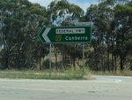 |
Mac's Reef Road Intersection: Intersection directional sign on the corner of Mac's Reef Road at Sutton, December 2009. Image © Paul Rands |
 |
AD Sign Northbound advance directional sign, 1 km from the Hume Hwy interchange at Wollogorang, June 2013. Click here for a photo of this location from December 2009. Image © Paul Rands |
|
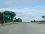 |
Advance Directional Sign: AD sign as you approach the interchange with Sutton Road at Sutton, July 2006. Note the incorrect NR23 sheild, should be a green and gold NH23 shield. Image © Paul Rands |
 |
Advance Directional Sign: AD sign approaching the interchange with the Hume Highway, northbound at Wollogorang, June 2013. Click here for a photo of this location from December 2009. Image © Paul Rands |
|
 |
Supplementary AD Sign: Sign indicating other destinations available from the Sutton Road interchange, July 2006. Image © Paul Rands |
 |
ID Sign: Northbound ID sign for the interchange at the Hume Highway (northern terminus of the Federal Highway) at Wollogorang, December 2009. Image © Paul Rands |
|
 |
Sutton Road Exit: Southbound at the Sutton Road interchange at Sutton, January 2010. Note the incorrect font used on the sign. Image © Paul Rands |
 |
Hume Highway: Northbound at the interchange with the Hume Highway (northern terminus of the Federal Highway) at Wollogorang, June 2013. Image © Paul Rands |
|
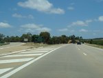 |
Sutton Road Interchange: View of the Sutton Road exit, Sutton Road overpass and the southbound carriageway of Federal Highway (NH23), January 2010. Image © Paul Rands |
|||
 |
Sutton Road Interchange: Approaching the Sutton Road bridge and onramp to the Federal Highway at Sutton, southbound, July 2006. Image © Paul Rands |
|||
 |
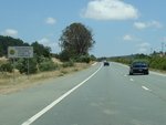
Distance Sign: Southbound RD sign after the Sutton Road interchange, with the old highway on the left and both carriageways of the current alignment, January 2010. Image © Paul Rands |
|||
 |
Remembrance Driveway: Sign indicating the Federal Hwy forms part of the Remembrance Driveway which commemorates Australia's War Heroes with a Living Memorial of those who served in the Australian Defence Forces in World War II and subsequent wars or conflicts. Click here for more information, January 2010. Image © Paul Rands |
|||
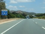 |
Services Sign: Sign indicating services available via Bidges Rd, Sutton, January 2010. Image © Paul Rands |
|||
 |
Exit to Federal Highway Service Road and Bidges Road: Southbound past the exit to the old Federal Highway alignment, which now acts as a service road for local roads and properites in Sutton, July 2006. The ramp also connects with Bidges Road. Image © Paul Rands |
|||
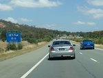 |
Services Sign: Sign at Sutton indicating services available at the Eagle Hawk Hill Interchange, January 2010. Click here for a photo of the old sign assembly from July 2006. Image © Paul Rands |
|||
 |
Eagle Hawk Hill Interchange: Southbound through the Eagle Hawk Hill interchange at Eagle Hawk Hill, July 2006. Image © Paul Rands |
|||
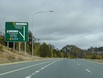 |
Advance Directional Sign: ACT design southbound AD sign for the Majura Road (ALT NR-23 / OD1) / Horse Park Drive interchange over the NSW-ACT border. Southbound at Sutton / Ginn's Gap, July 2006. Image © Paul Rands |
|||
 |
ACT Truck Bypass Sign: Just metres from the NSW-ACT border, southbound at Sutton / Ginns Gap, December 2009. Image © Paul Rands |
|||
| Click here for the continuation of National Highway 23 in the Australian Capital Territory | ||||
1 The Roadmakers, published by the Department of Main Roads
2 Roads and Traffic Authority
3 Canberra & District Historical Society
4 Sam Laybutt (OzRoads)
Last updated: 25-Feb-2017 22:46
This site © Paul Rands. All rights reserved. Some portions © (copyright) by their respective and credited owners. Permission must be obtained before using any images from this site. For details, please email by clicking here.