Road Photos & Information: New South Wales
 |
|
Lane Cove Tunnel, Hills Motorway, Old Windsor Road, Windsor Road & Bridge Street
(Metroad 2) - Construction Photos (Decommissioned) |
Statistics:
- Length: 46 km
- Eastern Terminus: Pacific Highway (Metroad 1), Gore Hill Freeway (Metroad 1) and Longueville Road, Lane Cove
- Western Terminus: Bridge Street and Macquarie Street, Windsor
- Suburbs, Towns & Localities along route:
Lane Cove, Lane Cove West, Lane Cove North, North Ryde, Macquarie Park,
Marsfield, Epping, Cheltenham, Beecroft, West Pennant Hills, North
Rocks, Baulkham Hills, Winston Hills, Seven Hills, Bella Vista,
Glenwood, Kellyville, Beaumont Hills, Rouse Hill, Box Hill, Riverstone,
Vineyard, McGraths Hills, Mulgrave and Windsor.
Route Numbering:
- Formerly:


- Decommissioned: 2013
- Road Authority Internal Classification: Main Road 635 (Old Windsor Road) / Main Road 184 (Windsor Road) 1
General Information:
Metroad 2 is a major route located in the Sydney
area, linking the northwestern suburbs with Sydney's inner suburbs, and
eventually via, several other routes to the central business district.
The standard of the route varies from multi-laned
arterial road through to freeway standard (covered by the 21 km long
Hills Mwy) 1. It passes through inner city suburbs, residential areas, light industrial areas and semi-rural areas.
The Hills Motorway segment of Metroad 2 was funded
and built by the private sector which will operate, maintain and repair
the motorway until 2042, when it will revert to the ownership of the
NSW government. The Hills Motorway consists of a four-lane expressway
plus a two-lane busway (between the east-bound and west-bound
carriageways) from Beecroft Road to Old Windsor Road, breakdown lanes
and cyclist lanes. 1
The route has gone through a number of signficant
changes since it was introduced, along with Sydney's other Metroads
back in the early 1990s. Several changes to routing have occured,
massive upgrades between Seven Hills and Windsor and more. Details of
the changes are covered in the history section below.
Metroad 2 features the following multiplexes:
- M7 from Abbott Road / Old Windsor Road interchange to Pennant Hills Road (Cumberland Highway) interchange at West Pennant Hills
The introduction of M7 is the first official public
display of alphanumeric route numbering in New South Wales, however
there has been several instances of incorrectly uncovered alphanumeric
shields across the state.
History:
The Roads and Traffic Authority's Heritage Register features a detailed history on the route, and can be found here.
- 1792 onwards: Construction of what is now named Windsor Road and Old Windsor Road. 1
- 1794: A road was established between the Green Hills / Hawkesbury area and the older settlement at Parramatta. 1
- 1797:
Governor Hunter ordered landholders to undertake road improvements
along the Hawkesbury Road, including widening the road to 20 feet.
(This is the date for the creation of the Windsor Road as a
carriageway). 1
- 1802:
A bridge was constructed at a new South Creek crossing of the Windsor
Road, financed by tolls, and replacing the previous punt crossing
further east. The current road alignment at South Creek dates from this
time. The earlier road alignment, leading to the punt crossing, is
reflected in the alignment of the present day Hawkesbury Road. 1
- 1805:
Surveyor James Meehan surveyed an alignment between Parramatta and
Kellyville which became the basis for the (New) Windsor Road in 1813. 1
- 1810:
Governor Macquarie established five towns along the Hawkesbury River:
Windsor, Richmond, Pitt Town, Wilberforce, and Castlereagh. A
contractor, James Harrex, was engaged to build a new turnpike road
between Parramatta and Kellyville, following Meehan's 1805 alignment
via Castle Hill. This new alignment would avoid the hilly section
(referred to by Governor King in 1803 as "the Seven Hills") of the
original (Old) Windsor Road. The new alignment also enabled a more
direct route to the Hawkesbury from Sydney. 1
- 1812:
Upon the failure of James Harrex to complete the new road works, John
Howe took over and completed the contract, which included the
construction of 70 bridges. The new road was 32 feet wide and alignment
stones marked the carriageway. 1
- 1810s:
Governor Macquarie introduced a toll system on the Windsor Road with
toll gates north of Parramatta and south of Rouse Hill. 1
- 1816: Construction of a toll house at Rouse Hill. 1
- 11
September 1833: Windsor Road was proclaimed as a Main Road and
gazetted, with Old Windsor Road being declared a Parish Road. 1
- 1835 A toll house, the second on the site, was constructed at the South Creek crossing near Windsor. 1
- 1849: The Windsor Road Trust was formed to oversee maintenance of the Windsor Road. 1
- 1853: Fitzroy Bridge constructed across South Creek at Windsor, replacing the earlier Howe's Bridge. 1
- 1924:
The Department of Public Works used water-based macadam in
reconstructing the Windsor Road near Rouse Hill. Water-based macadam
was an improved road surface treatment necessitated by the rapid rise
of the motor vehicle. 1
- 1926: A bitumen coating was laid completed on Windsor Road near Rouse Hill, and renewed in 1928-9. 1
- 22 May 1928: Windsor Road, together with Bells Line of Road and the Darling Causeway was announced as Main Road 184. 1
- 1940s:
Cutting and filling of the Old Windsor and Windsor Roads was reportedly
undertaken by the United States military to prepare evacuation routes
should a Japanese invasion take place in Sydney. 1
- 1948: Shoulders of the Windsor Road were widened to 22 feet to provide for anticipated traffic. 1
- 1981-1984:
High-level bridges constructed by the Department of Main Roads over
Pye's Crossing and Johnston's Bridge. The last unmade section of Old
Windsor Road was surfaced by Blacktown and Baulkham Hills Councils. 1
- 26 May 1997: Hills Motorway opens to traffic, given Metroad 2 designation. 1
- October 2002: Upgrade to four lanes from Norbrik to Celebration Drive, Glenwood completed. 1
- March 2002: Upgrade to four lanes from Sunnyholt Road to Merriville Road, Kellyville completed. 1
- June 2002: Upgrade to four lanes from Henry Road to Curtis Road, Vineyard completed. 1
-
February 2003: Intersection improvements at Old Windsor Road and Seven
Hills Road, and Seven Hills Road to Abbott Road, Seven Hills completed.
1
- August 2003: Upgrade to four lanes from Merriville Road to Scholfields Road, Rouse Hill completed. 1
-
April 2004: Upgrade to four lanes from Schofields Road to Mile End
Road, Rouse Hill completed, and also the upgrade to four lanes from
Level Crossing Road to Henry Road, Vineyard completed, plus the upgrade
to four lanes from Curtis Road, Vineyard to Pitt Town Road, McGraths
Hill completed. 1
- December 2004: Upgrade to four lanes from Norwest Boulevarde to Showground Road, Castle Hill completed 1
-
July 2006: Upgrade to four lanes from Roxborough Park Road to Norwest
Boulevards, Baulkham Hills completed, also the upgrade to four lanes
from Acres Road to Old Windsor Road, Kellyville completed. 1
- September 2006: Upgrade to four lanes from Boundary Road to Level Crossing Road, Vineyard completed. 1
- December 2006: Upgrade to four lanes opened to traffic from Mile End Road, Rouse Hill to Boundary Road, Box Hill. 1
- March 2007: Metroad 2 rerouted from Epping and Longueville Roads to the then newly opened Lane Cove Tunnel. 1
 |
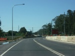
Windsor Road Upgrade:
Upgrade to dual carriageway underway between Latona Avenue and Chapman Road Vineyard, October 2005.
Image © Paul Rands |
 |
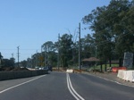
Construction Works Vineyard:
Upgrade to dual carriageway underway between Latona Avenue and Chapman Road Vineyard, October 2005.
Image © Paul Rands |
 |
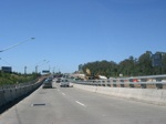
Norwest Blvd Interchange Works:
Construction around the Norwest Boulevard at Bella Vista, October 2005.
Image © Paul Rands |
 |
Bella Vista Roadworks:
Old Windsor Road using what is now the interchange with Norwest
Boulevard as the inbound carriageway at Bella Vista during widening
works, October 2005. Image © Paul Rands |
1 Roads and Traffic Authority
Last updated: 08 Nov 2019 01:09
This site ©
Paul
Rands. All rights reserved. Some portions © (copyright) by their
respective and credited owners. Permission must be obtained before using
any images from this site. For details, please email by clicking
here.

