|
|
|
|
|
| M15 A15 | Parry Street, Donald Street, Griffiths Road, Newcastle Road, Thomas Street, Newcastle Link Road, Hunter Expressway & New England Highway (M15 / A15) - Seahampton to Singleton |
Statistics:
Route Numbering:


General Information:
M15 / A15 is one the major routes in New South Wales and Queensland. It links the farming regions of NSW to the ports at Newcastle and also to other major roads to Sydney and it's also a link to Brisbane's metropolitan area.
The route consists of single carriageway 2-lane rural highway, through to multi-lane divided sections and motorway standard closer to Newcastle.
History:
The New England Highway originally formed part of the Great Northern Road from Sydney via Wiseman's Ferry to the Queensland border (near Mt Lindesay), taking shape as settlement spread northward from the lower Hunter Valley. By 1851 the Great Northern Road had reached the Gap, two miles beyond Murrurundi. In 1858 it was classified as one of three Main Roads in the colony (Great Western and Great Southern) and extended from Morpeth via Maitland, Singleton, Muswellbrook, Scone, Murrurundi and Tamworth, to Armidale, a distance of about 236 miles. Captain Martindale, Chief Railway Commissioner, who was also responsible for roads, stressed the need for bridges as in many cases long circuits had to be made to find a crossing over a stream. In 1860 arrangements were in progress for building 90 culverts and minor bridges and for forming new sections of road, including a new ascent to Murrurundi Gap, which was previously steep with sharp dangerous turns. In 1865 the section of road between Muswellbrook and Murrurundi was metalled and a deviation suggested between Blandford and Murrurundi to skirt the Page River, obviating two bridges, however, such a deviation was never constructed. With the construction of the Northern Railway line from Newcastle, commenced in the 1850s and reaching Murrurundi in 1872, attention was diverted away from roads and sections of the Great Northern Road were in poor condition. Despite the impact of the railway, roads developed steadily and considerable progress was made in the bridging of rivers and creeks. 2
| Preview: | Description: |
 |
NEW! Advance Directional Sign: AD sign on the off ramp from Pacific Mwy (M1) onto Hunter Expwy (M15) and Newcastle Link Rd (A15) at Seahampton, April 2019. Image © Paul Rands |
 |
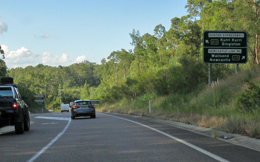
NEW! Intersection Directional Signs: ID signs on the off ramp from Pacific Mwy (M1) onto Hunter Expwy (M15) and Newcastle Link Rd (A15) at Seahampton, April 2019. Image © Paul Rands |
 |
Advance Directional Sign: AD sign at Buchanan approaching John Renshaw Dr (B68) interchange, December 2016. Image © Spenser Tan |
 |
Advance Directional Sign: AD sign at Buchanan approaching John Renshaw Dr (B68) interchange, December 2016. Image © Spenser Tan |
 |
Distance Sign: Reassurance directional sign after John Renshaw Dr (B68) at Buchanan, December 2016. Image © Spenser Tan |
 |
Advance Directional Sign: AD sign at Buchanan approaching the interchange with Main Rd, April 2019. Image © Paul Rands |
 |
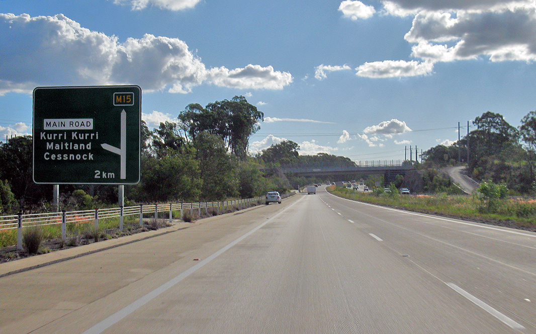
Advance Directional Sign: AD sign at Kurri Kurri approaching the interchange with Main Rd, December 2016. Image © Spenser Tan |
 |
Distance Sign: RD sign at Kurri Kurri after Main Rd, December 2016. Image © Spenser Tan |
 |
Advance Directional Sign: AD sign at Kurri Kurri approaching Hart Rd, April 2019. Image © Paul Rands |
 |
NEW! Reassurance Directional Sign: Exit distance sign at Allandale, April 2019. Image © Paul Rands |
 |
Advance Directional Sign: AD sign at Allandale approaching Lovedale Rd, December 2016. Image © Spenser Tan |
 |
NEW! Reassurance Directional Sign: Exit distance sign at Greta, April 2019. Image © Paul Rands |
 |
Advance Directional Sign: AD sign at Greta approaching Wine Country Dr (B82), December 2016. Image © Spenser Tan |
 |
NEW! Supplemental Advance Directional Sign: Supplemental AD sign at Greta approaching Wine Country Dr (B82), April 2019. Image © Paul Rands |
 |
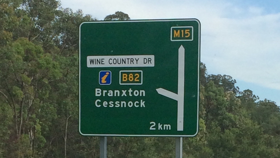
NEW! Advance Directional Sign: AD sign at Greta approaching Wine Country Dr (B82), April 2019. Image © Paul Rands |
 |
NEW! End Freeway 2km: Sign on Hunter Expwy (M15) at Branxton indicating end of freeway conditions in 2 km, approaching New England Hwy (A15), April 2019. Image © Paul Rands |
 |
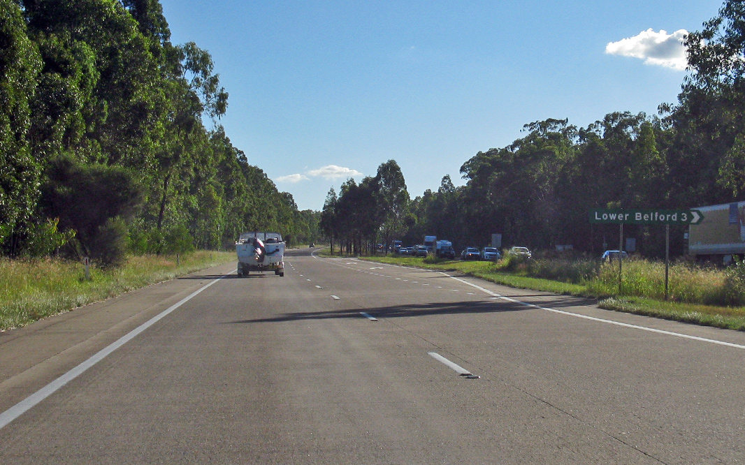
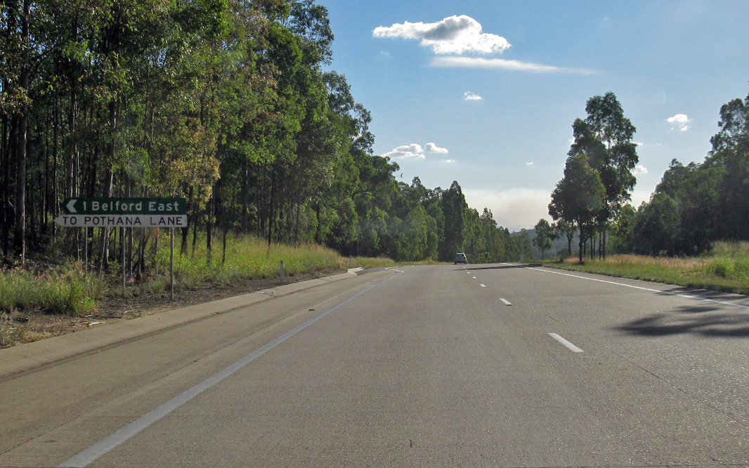
NEW! Reassurance Directional Sign: Exit distance sign at Belford, April 2019. Image © Paul Rands |
 |
NEW! Kirkton Road: Corner of New England Hwy (A15) and Kirkton Rd at Belford, April 2019. Image © Paul Rands |
 |
NEW! Pothana Lane: Corner of New England Hwy (A15) and Pothana Ln at Belford, April 2019. Image © Paul Rands |
 |
NEW! Hermitage Road: Corner of New England Hwy (A15) and Hermitage Rd at Belford, April 2019. Image © Paul Rands |
 |
Advance Directional Sign: AD sign at Whittingham approaching Golden Hwy (B84), December 2016. Image © Spenser Tan |
 |
Intersection
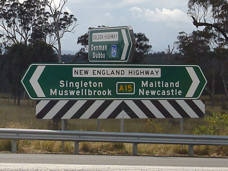
Directional Sign: ID sign assembly on the corner of Golden Hwy (B84) and New England Hwy (A15) at Whittingham. September 2007. Image © Paul Rands |
| Click here for the continuation of the route as Newcastle Link Road (A15) between Newcastle and Seahampton Click here for the continuation of New England Highway (A15) between Singleton and Muswellbrook |
|
1 Roads &
Maritime Services, Schedule of Classified Roads and Unclassified Regional
Roads, August 2013
2 Roads & Maritime Services
3 Roads & Maritime Services, Projects, The Hunter Expressway, Project overview
4 NSW Government, Roads & Maritime Services, Media Statement, Major Road Safety Upgrade Completed On The New England Highway At Whittingham, 26 July 2013
5 NSW Government, Roads & Maritime Services, Joint Media Statement, Hunter Expressway opens for business, 21 March 2014
6 NSW Government, Roads & Maritime Services, Media Statement, Safety Improved On The New England Highway At Whittingham, 21 July 2017
7 NSW Government, Roads & Maritime Services, Media Statement, Whittingham rest area permanently closing on Monday 3 February 2020, December 2019
8 NSW Government, Roads & Maritime Services, Media Statement, Start of work on the New England Highway, Whittingham from Monday 19 April, April 2019
Last updated: 23:43:30 30/10/2012.
This site © Paul Rands. All rights reserved. Some portions © (copyright) by their respective and credited owners. Permission must be obtained before using any images from this site. For details, please email by clicking here.