Statistics:
- Length:
- 90 km
- Termini:
- Eastern: Windsor Rd (A2), McGraths Hill
- Western: Great Western Hwy (A32) and Caroline Av, Lithgow
- Suburbs, Towns & Localities Along Route:
- Windsor, Richmond, North Richmond, Kurrajong, Kurrajong Heights, Bilpin, Berambing, Mount Tomah, Dargan, Bell and Lithgow
Route Numbering:
- Current: B59
- Former: 40
- Road Authority Internal Classification: 1
- MR184
General Information:
B59 is an alternative route over the Blue Mountains, connecting the state's west to Sydney.
The route is quite windy and hilly once off the Cumberland Plain, as it crosses the Great Dividing Range. The line it follows dates back to the 1800s. The route passes through residential and commercial areas, as well as some rural and large tracts of forested areas.
History:
- 1939: Work begins to improve the condition of Bells Line of Road, as an unemployment relief program. Work commenced in the Bell area. 2
- 1950: Completion of improvement works along Bells Line of Road, covering a distance of slightly over 34 miles. 2
- February 2009: Richmond Road between Windsor and Richmond renamed Hawkesbury Valley Way, in conjunction with the completion of the Windsor Flood Evacuation route. 3

NEW Intersection Directional Sign:
ID sign at the corner Windsor St (B59 and unnumbered) and East Market St (B59 and unnumbered) in Richmond, November 2019. B59 turns left at this location.
Image © Paul Rands

NEW Advance Directional Sign:
AD sign adjacent to the railway station on East Market St (B59) in Richmond, approaching East Market St (unnumbered) and March St (B59 and unnumbered), November 2019.
Image © Paul Rands

Intersection Directional Sign:
ID sign at the corner of March St (unnumbered and B59) and East Market St (unnumbered and B59) in Richmond, March 2016. B59 turns right at this junction.
Image © Paul Mech

Intersection Directional Signs:
UPDATED ID signs at the corner of March St (unnumbered and B59) and East Market St (unnumbered and B59) in Richmond, January 2022.
Image © Paul Rands

NEW Advance Directional Sign:
AD sign on East Market St (unnumbered) in Richmond, approaching East Market St (B59) and March St (B59 and unnumbered), January 2022.
Image © Paul Rands

NEW Intersection Directional Sign:
ID sign at the corner of March St (unnumbered and B59) and East Market St (unnumbered and B59) in Richmond, January 2022.
Image © Paul Rands

NEW Advance Directional Sign:
AD sign on March St (B59) approaching Bosworth St in Richmond, January 2022.
Image © Paul Rands

NEW Bosworth Street:
Corner of March St (B59) and Bosworth St in Richmond, January 2022.
Image © Paul Rands

Distance Sign:
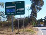
UPDATED Reassurance directional sign on Kurrajong Rd (B59) in Richmond, January 2022. Click or tap here for a photo of this location by Peter Renshaw from August 2013.
Image © Paul Rands

NEW Entering North Richmond:
Kurrajong Rd (B59) as it enters North Richmond, January 2022. B59 becomes Bells Line of Road beyond this point.
Image © Paul Rands

NEW Grose Vale Road & Terrace Road:
Corner of Bells Line of Road (B59), Grose Vale Road and Terrace Road, North Richmond, January 2022.
Image © Paul Rands

Advance Directional Sign:
AD sign approaching Comleroy Rd and Old Bells Line Of Rd at Kurrajong, August 2013.
Image © Peter Renshaw

Distance Sign:
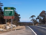
Reassurance directional sign as Bells Line Of Road leaves Bell, August 2013.
Image © Peter Renshaw

Intersection Directional Sign:
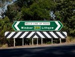
ID sign facing Comleroy Rd in Kurrajong, August 2011.
Image © Paul Mech

Intersection Directional Sign:
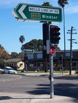
ID sign at the corner of Terrace Rd and Grose Vale Rd at North Richmond, August 2013.
Image © Peter Renshaw

NEW Bosworth Street:
Corner of March St (B59) and Bosworth St, Richmond, January 2022.
Image © Paul Rands

NEW Intersection Directional Sign:
ID sign assembly facing Bosworth St at its junction with March St (B59) in Richmond, November 2019.
Image © Paul Rands

NEW Advance Directional Sign:
AD sign on March St (B59) approaching March St (unnumbered) and East Market St (B59 and unnumbered), January 2022.
Image © Paul Rands

Intersection Directional Signs:
UPDATED ID signs at the corner of March St (unnumbered and B59) and East Market St (unnumbered and B59) in Richmond, January 2022. B59 turns left at this junction.
Image © Paul Rands

NEW Reassurance Directional Sign:
Distance sign on Hawkesbury Valley Way (B59) in Richmond, January 2022.
Image © Paul Rands

NEW Advance Directional Sign:
AD sign approaching Percival St in Clarendon, January 2022.
Image © Paul Rands

NEW Percival Street:
Corner of Hawkesbury Vly Way (B59) and Percival St in Clarendon, January 2022.
Image © Paul Rands

NEW Entering Windsor:
Hawkesbury Vly Way (B59) as it enters the town of Windsor, January 2022.
Image © Paul Rands

NEW Supplemental Advance Directional Sign:
Supplemental AD sign near George St in Windsor for Macquarie St (A9), January 2022.
Image © Paul Rands

NEW George Street:
Corner of Hawkesbury Vly Way (B59) and George St in Windsor, January 2022.
Image © Paul Rands

NEW Advance Directional Sign:
AD sign approaching Macquarie St (A9) in Windsor, January 2022.
Image © Paul Rands

NEW Macquarie Street:
Corner of Hawkesbury Vly Way (B59) and Macquarie St (A9) in Windsor, January 2022.
Image © Paul Rands
1 NSW Government, Transport for NSW, Schedule of Classified Roads And State and Regional Roads, July 2022.
2 NSW Government, Department of Main Roads. The Roadmakers, A History of Main Roads in New South Wales, ISBN 0 7240 0439 4.
3 Paul Mech.


