Road Photos & Information: Australian Capital Territory
Parkes Way (Unnumbered)
Construction Photos
Statistics:
- Length:
- 7 km
- Termini:
- Eastern: Morshead Drive and Kings Avenue at Russell
- Western: Glenloch Interchange (William Hovell Dr, Tuggeranong Pkwy and Caswell Dr) at Acton
- Suburbs, Towns & Localities Along Route:
- Acton, Civic, Reid, Campbell and Russell
Route Numbering:
- Current: None
General Information:
Parkes Way is located along the northern foreshore of Lake Burley Griffin and is a major east-west route for traffic to and from the airport, Civic, and parts of Belconnen, Woden and Tuggeranong.
It's divided for its enitre length and travels via tunnel under the Australian National University (ANU).
Major routes Parkes Way connects to include Tuggeranong Parkway, William Hovell Drive, Commonwealth Avenue (A23), Anzac Parade and Morshead Drive.
The road is named after Sir Henry Parkes, who was a legislator, federalist and one of the Founders of the Constitution. He became Premier of New South Wales in 1872, advocating union of the Australian colonies from 1867. He died 1896 before the first Federal Parliament. 1
History:
- 21 July 1960: Name was gazetted. 1
- 29 November 1961: Parkes Way between Kings Avenue and Scotts Crossing. 2
- 1963: Construction begins on Parkes Way, east of Commonwealth Avenue. 3
- 5 April 1963: Parkes way between Anzac Park and Allara Street opened to traffic. 4
- 17 October 1979: 5.5 kilometre section of the Molonglo Arterial (Parkes Way), the Glenloch Interchange and the Lakeside Interchange (on Tuggeranong Parkway) opened to traffic. The $27 million road included 20 kilometres of carriageway, 8 bridges, the Acton tunnel and 7 kilometres of pedestrian and cycle paths. 5
- 2008: Commencement of the replacement of Kings Way / Parkes Way roundabout at Russell with grade separated full diamond interchange 6
- January 2014: Opening of a third lane from Glenloch Interchange to Edinburgh Avenue in both directions. Other work included increasing the length of the merging lane with London Circuit and the installation of new street lighting. 7
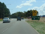
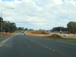
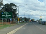
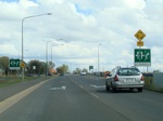
This page concentrates on construction photos of the Kings Avenue / Parkes Way / Morshead Drive interchange.
Russell To Glenloch Interchange
Glenloch Interchange To Russell
2 Canberra Times, Page 4, 29 November 1961
3 National Library of Australia.
4 Canberra Times, Page 7, 4 April 1963
5 Canberra Times, Page 10, 16 October 1979
6 Department of Infrastructure, Transport, Regional Development and Local Government
7 Territory and Municipal Services, Roads and Transport, Major Construction Projects, Completed Projects, Parkes Way Widening


