|
|
|
|
|

|
Federal Highway (National Highway 23) |
Statistics:
Route Numbering:


General Information:
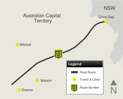
The ACT section of NH23 is quite short, travelling just 7 kilometres from the NSW-ACT Border to the junction with the Barton Highway and Northbourne Avenue at Downer. National Highway 23 continues on from the Federal Highway in New South Wales.
The entire route is 4-lane dual carriageway with 2 lanes in each direction for north and southbound traffic. The route features both at grade intersections and also a grade-separated interchange with Alternate National Route 23, Majura Road and also Horse Park Drive, both in the North Canberra locale.
History:
| NSW Border to Downer | Downer to NSW Border | |||
| Preview: | Description: | Preview: | Description: | |
 |
ACT Welcome Sign: Crossing from NSW into the ACT, southbound at Ginns Gap. This sign is a newer version of a similar design built in the 1960s or 70s. This sign was erected sometime between 1999 and 2002 as part of the duplication works. Heading north is a similar sign with New South Wales on it. July 2006. Image © Paul Rands |
 |
Advance Directional Sign: AD sign approaching Phillip Av, Lyneham, December 2009. Image © Paul Rands |
|
 |
Welcome to Canberra Sign: Sign welcoming visitors to Canberra, and also indicates the traditional owners of the land around the ACT area, Watson, December 2009. Image © Paul Rands |
 |
Advance Directional Sign: AD sign at Lyneham, approaching Flemington Road, December 2009. Image © Paul Rands |
|
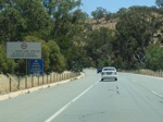 |
Urban Speed Limit Sign: Sign at Watson incdicating the urban speed limit in the ACT. December 2009. Image © Paul Rands |
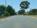 |
Heavy Vehicle Route Signage: Sign at Kenny denoting the direction of the heavy vehicle route, December 2009. Image © Paul Rands |
|
 |
Majura Road / Horse Park Drive Interchange: Southbound approaching the interchange for Majura Road (ALT-NR23) and Horse Park Drive, Watson. December 2009. Image © Paul Rands |
 |
Trailblazer: This photo from 2004 shows a trailblazer attached to a lamp post, near the intersection of Stirling Avenue at Kenny, northbound on Federal Highway. Image © Sam Laybutt (ozroads.com.au) |
|
 |
Advance Directional Sign: AD sign at Watson for the Hughie Edwards VC Rest Area, December 2009. Image © Paul Rands |
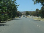 |
Stirling Av, Watson: Approaching the signalised junction with Stiring Avenue & Exhibition Park at Kenny, December 2009. Image © Paul Rands |
|
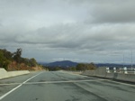 |
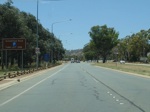
Majura Road / Horse Park Drive Interchange: Southbound through the interchange for Majura Road (ALT-NR23) and Horse Park Drive, North Canberra. Note Telstra Tower atop Black Mountain, in the distance. July 2006. Image © Paul Rands |
 |
Advance Directional Sign: AD sign at Kenny approaching Well Station Road, December 2009. Image © Paul Rands |
|
 |
Distance Sign: Large RD as you head southbound at Watson, just before the Antill Street roundabout, January 2010. Image © Paul Rands |
 |
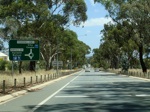
Old Well Station Road Junction: Corner of Federal Hwy & Old Well Station Rd at Kenny, November 2013. Click here for a photo of this location from December 2009. Image © Paul Rands |
|
 |
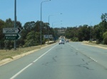
Approaching Antill Street: Southbound advance directional sign for the Antill Street roundabout at Watson, January 2010. Image © Paul Rands |
 |
Intersection Directional Sign: ID sign near the Zelling Street intersection at Kenny, December 2009. Image © Paul Rands |
|
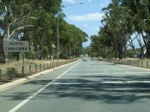 |
Entering North Canberra: Federal Hwy as it officially enters the North Canberra region of the ACT, at Watson, January 2010. Image © Paul Rands |
 |
Heavy Vehicle Route Signage: Sign at Kenny denoting the direction of the heavy vehicle route, December 2009. Image © Paul Rands |
|
 |
Antill Street Approach: Southbound at Watson, approaching Antill Street, note the white lines across the lanes - they're used to alert drivers to the upcoming roundabout as they come out of an 80 km/h zone. January 2010. Image © Paul Rands |
 |
Approaching Antill Street: Advance directional sign for the Antill Street roundabout at Kenny, December 2009. Image © Paul Rands |
|
 |
Truck Route Sign: Truck route sign approaching Antill St roundabout at Watson, January 2010. Image © Paul Rands |
 |
ID Sign: Intersection directional sign at Kenny near Antill St, December 2009. Image © Paul Rands |
|
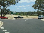 |
Intersection Directional Sign: ID sign on the Antill St roundabout at Watson, January 2010. Image © Paul Rands |
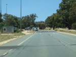 |
Remembrance Driveway Sign: Remembrance Driveway sign near Antill Street at Kenny, December 2009. Image © Paul Rands |
|
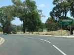 |
Antill Street Roundabout: Southbound signage and exit from the Antill Street roundabout at Watson, July 2006. Image © Paul Rands |
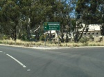 |
Intersection Directional Sign: ID sign on the Antill St roundabout at Watson, December 2009. Image © Paul Rands |
|
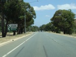 |
Intersection Directional Sign: ID sign near the Zelling Street intersection at Watson, January 2010. Image © Paul Rands |
 |
Distance Sign: RD sign after the Antill Street roundabout, Gungahlin, December 2009. Image © Paul Rands |
|
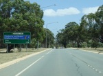 |
Distance Sign: Large RD as you head southbound at Watson, just after the Antill Street roundabout and before the Stirling Avenue traffic lights, January 2010. Click here for the old version of this sign, taken in July 2006. Image © Paul Rands |
 |
Advance Directional Sign: AD sign at Kenny, for the Horse Park Drive and Majura Parkway (M23) interchange, December 2009. Image © Paul Rands |
|
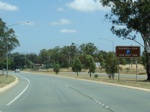 |
Advance Directional Sign: AD sign at Watson approaching Wells Station Road, January 2010. Image © Paul Rands |
 |
Horse Park Drive and Majura Parkway Interchange: Federal Hwy at the Horse Park Dr Majura Rd interchange, Kenny, December 2009. Image © Paul Rands |
|
 |
Old Well Station Road Junction: Corner of Federal Hwy & Old Well Station Rd at Watson, January 2010. Image © Paul Rands |
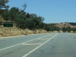 |
Advance Directional Sign: AD sign at Throsby for the Hughie Edwards VC Rest Area, December 2009. Image © Paul Rands |
|
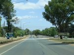 |
Stirling Av, Watson: Southbound approaching the signalised junction with Stiring Avenue & Exhibition Park at Watson, January 2010. Note the brown ID sign has been modified, you can see the outline of the old lettering. Image © Paul Rands |
 |
Distance Sign: RD sign after the Majura Pkwy (M23) interchange at Throsby, December 2009. Image © Paul Rands |
|
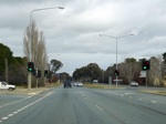 |
Stirling Avenue Intersection: Southbound carriageway of the Federal Highway as it passes across Stirling Avenue's signalised intersection, July 2006. Image © Paul Rands |
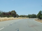 |
Tourist Sign: Tourist signage indicating distance to Lake George wineries, Throsby, December 2009. Image © Paul Rands |
|
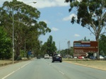 |
Advance Directional Sign: AD sign at Watson, approaching Flemington Road, January 2010. Image © Paul Rands |
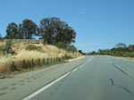 |
ACT-NSW Border: Federal Hwy at Ginns Gap, crossing into New South Wales. December 2009. Image © Paul Rands |
|
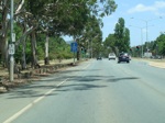 |
Old NR23 Trailblazer: Old handpainted National Route 23 trailblazer, near the Flemington Rd intersection at Watson, January 2010. Image © Paul Rands |
|||
 |
Flemington Road Intersection: Advance directional signage for the tourist information centre, and the Flemington Rd intersection at Watson, January 2010. Image © Paul Rands |
|||
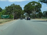 |
Distance Sign: Southbound RD sign after the Stirling Avenue junction at Watson, January 2010. Note the incorrect NR23 shield on the sign. Click here for the old version of this sign from July 2006. Image © Paul Rands |
|||
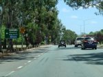 |
Advance Directional Sign: AD sign approaching Phillip Av, Watson, January 2010. Image © Paul Rands |
|||
 |
Approaching Barton Hwy: Southbound after Phillip Avenue Watson as you approach the turn off to the Barton Highway (National Highway 25), and also the southern terminus of the Federal Highway. Downer, January 2010. Image © Paul Rands |
|||
 |
Advance Directional Sign: AD sign for the Barton Highway intersection, southbound at Downer. January 2010. Image © Paul Rands |
|||
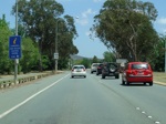 |
AD Sign: AD sign at Downer near the Barton Hwy junction for the tourist information centre, January 2010. Image © Paul Rands |
|||
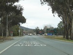 |
End National Highway 23: The southern terminus of the Federal Highway at Downer, the road continues as Northbourne Avenue, National Route 23. Southbound, July 2006. Image © Paul Rands |
|||
| Click here for the continuation of Federal Hwy as M23 in NSW Click here for the continuation of NR23 (as Northbourne Avenue) |
||||
1 The Roadmakers, A History of Main Roads in New South Wales, ISBN 0724004394, 1976
2 Ozroads (Sam Laybutt), National Highway 23 - Federal Highway
3 ACT Planning & Land Authority, Variation to the Territory Plan, No 67, August 1998
Last updated: 19-Feb-2017 13:42
This site © Paul Rands. All rights reserved. Some portions © (copyright) by their respective and credited owners. Permission must be obtained before using any images from this site. For details, please email by clicking here.