|
|
|
|
|
| B52 | Hindmarsh Drive, Canberra Avenue & Kings Highway (B52) |
Statistics:
Route Numbering:

General Information:
The Kings Highway is the main road to the NSW south coast, travelling through Queanbeyan and several small NSW towns, connecting with the Princes Highway on the coast at Batemans Bay.
The ACT section of B52 is quite short, and in 2 pieces.
One section covers just 5 kilometres from the junction with the Monaro Highway and Canberra Avenue at Fyshwick to the NSW-ACT Border at Beard. The other section joins the NSW section of B52, northeast of Queanbeyan, for the remaining 9 km at Kowen, before continuing over the NSW-ACT border again towards Bungendore.
The entire Canberra Avenue alignment is multi-lane dual carriageway. Canberra Avenue was known during the 1930s as Uriarra Road. 1 The Kings Highway section is undivided rural highway standard.
History:

| Symonston to Kowen | Kowen to Symonston | |||
| Preview: | Description: | Preview: | Description: | |
 |
Advance Directional Sign: Canberra Av (unnumbered) approaching Newcastle St and Hindmarsh Dr at Fyshwick, November 2016. The A23 route number is in error and should be B52. Image © Paul Rands |
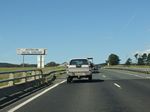 |
NSW-ACT Border: Kings Hwy (B52) as it crosses from NSW into ACT at Kowen, November 2013. Image © Paul Rands |
|
 |
Advance Directional Sign: AD sign at Symonston approaching Canberra Av (unnumbered / B52) and Newcastle St, November 2013. Image © Paul Rands |
 |
Approaching Sparrow Hill Road: Kings Hwy (B52) approaching Sparrow Hill Rd at Kowen, November 2013. Sparrow Hill Rd is a former alignment of Kings Hwy. Image © Paul Rands |
|
 |
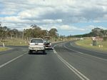
Canberra Avenue / Newcastle Street Intersection: Corner of Hindmarsh Dr, Canberra Av & Newcastle St at Symonston, November 2013. Image © Paul Rands |
 |
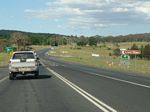
Sparrow Hill Road: Kings Hwy (B52) at the junction with Sparrow Hill Rd at Kowen, November 2013. Image © Paul Rands |
|
 |
Intersection Directional Sign: ID sign at the corner of Hindmarsh Dr, Canberra Av & Newcastle St at Symonston, August 2010. Image © Paul Rands |
 |
Approaching Hibernian Road: Kings Hwy (B52) at Kowen approaching Hibernian Rd (former Kings Hwy alignment), November 2013. Image © Paul Rands |
|
 |
Intersection Directional Sign: ID sign at the corner of Hindmarsh Dr, Canberra Av & Newcastle St at Symonston, November 2013. Image © Paul Rands |
 |
Hibernian Road: Kings Hwy (B52) at Kowen at the junction with Hibernian Rd, November 2013. Image © Paul Rands |
|
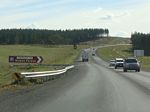 |
Approaching Hibernian Road: Kings Hwy (B52) at Kowen approaching Hibernian Rd (former Kings Hwy alignment), November 2013. Image © Paul Rands |
 |
Advance Directional Sign: AD sign at Kowen approaching the HQJOC, November 2013. HQJOC, short for The Australian Headquarters Joint Operations Command (HQJOC), is the Australian Defence Force's (ADF) operational level headquarters responsible for the command and control of ADF operations worldwide. Image © Paul Rands |
|
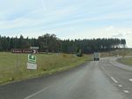 |
Hibernian Road: Corner of Kings Hwy (B52) and Hibernian Rd at Kowen, November 2013. Image © Paul Rands |
 |
Distance Sign: Reassurance directional sign at Symonston, August 2010. Image © Paul Rands |
|
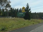 |
Distance Sign: Reassurance directional sign after Hibernian Rd at Kowen, November 2013. Image © Paul Rands |
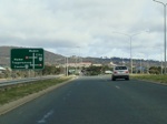 |
Advance Directional Sign: AD sign at Symonston approaching the Monaro Hwy (A23) interchange, August 2010. Image © Paul Rands |
|
 |
Approaching Sparrow Hill Road: Kings Hwy (B52) approaching Sparrow Hill Rd at Kowen, November 2013. Sparrow Hill Rd is a former alignment of Kings Hwy. Image © Paul Rands |
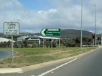 |
Monaro Highway Interchange: Corner of Hindmarsh Dr (B52 and unnumbered) and Monaro Hwy (A23) at Symonston, August 2010. This is the western terminus of B52. Image © Paul Rands |
|
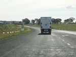 |
Sparrow Hill Road: Corner of Kings Hwy (B52) and Sparrow Hill Rd at Kowen, November 2013. Image © Paul Rands |
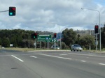 |
Monaro Highway Interchange: Corner of Hindmarsh Dr (B52 and unnumbered) and Monaro Hwy (A23) at Symonston, August 2010. This is the western terminus of B52. Image © Paul Rands |
|
| Click here for the continuation of B52 in New South Wales | ||||
1 ACT Memorial, Stanley George Murray Gillespe
2 ACT Planning & Land Authority, Place Name Search, Canberra Avenue
3 Sam Laybutt (ozroads.com.au)
4 Canberra Times, Page 3, 30 July 1976
5 Canberra Times, Page 7, 6 May 1977
6 Canberra Times, Page 6, 16 April 1982
7 Canberra Times, Page 9, 6 February 1988
8 Canberra Times, Page 5, 22 November 1989
9
Hewatt Group, Completed Projects
10 ACT Government, Transport Canberra and City Services, Guide Signs, Municipal Infrastructure Standards 12, April 2019
Last updated: 12-Aug-2020 23:43
This site © Paul Rands. All rights reserved. Some portions © (copyright) by their respective and credited owners. Permission must be obtained before using any images from this site. For details, please email by clicking here.