Statistics:

Length:
7 km
Termini:
Northern: Commonwealth Av (NR23) and Queen Victoria Tce at Yarralumla
Southern: State Cir (NR23) and Brisbane Av at Barton
Roads that form the route:
Coronation Drive, Forster Crescent, Empire Circuit, Schlich Street, Hopetoun Circuit, Melbourne Avenue and State Circle
Suburbs, Towns & Localities Along Route:
Yarralumla, Deakin, Forrest and Barton

Route Numbering:

Former: 6
Multiplexed with: 5 23

General Information:

The Embassies Tour was designed to give a visitor easy access to view the various façades of the embassies dotted through the southern suburbs of Canberra.

History:

1930s: Construction commenced on State Circle around Capital Hill 1
1960s: State Circle fully complete after being only three quarters built for several years 1
1988: Opening of Parliament House upon Capital Hill by HRH Queen Elizabeth II

Barton to Yarralumla

image

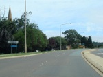
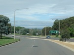
Entering Forrest:

State Circle as you enter the suburb of Forrest, February 2011.

Image © Paul Rands

image

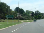
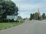
Advance Directional Sign:

AD sign as you approach Canberra Avenue on State Circle at Forrest. February 2011.

Image © Paul Rands

image

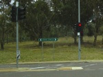
Hobart Avenue:

ID sign on State Circle, for Hobart Avenue in Forrest. February 2011.

Image © Paul Rands

image

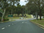
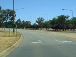
Advance Directional Sign:

AD sign on State Circle in Deakin, approaching Melbourne Avenue, February 2011.

Image © Paul Rands

Yarralumla to Barton

image

Melbourne Avenue:

Outside Canberra Girls Grammar School. This is looking northeast - this side of the street is Deakin, the other side is Forrest. July 2006.

Image © Paul Rands

image

Approaching State Circle:

Melbourne Avenue in Deakin as it approaches Capital Hill and State Circle, July 2006. Note the hand painted Right Lane Must Turn Right sign.

Image © Paul Rands

image

State Circle ID Sign:

Older style road name signage on State Circle at Deakin / Capital Hill. This sign would have been a 1990s direct remake of an old black sign. July 2006.

Image © Paul Rands

image

Advance Directional Sign:

AD sign on State Circle approaching Melbourne Avenue, February 2011.

Image © Paul Rands

image

Eastbound on State Circle:

ID sign for Hobart Avenue as you head east on State Circle near Parliament House and the suburb of Forrest. February 2011.

Image © Paul Rands

image

Black Directional Sign:

Black ID sign as you approach Canberra Avenue on State Circle at Forrest. February 2011.

Image © Paul Rands

image

Approaching Brisbane Avenue:

Heading north near the junction with Brisbane Avenue. Capital Hill is on the left of the road and the suburb of Barton is on the right, December 2009.

Image © Paul Rands

image

Tourist Drive 6 Trailblazer:

TD6 trailblazer on Capital Hill near the junction with Brisbane Avenue, December 2009.

Image © Paul Rands

image

End Tourist Drive 6:

End TD6 trailblazer on Capital Hill near the junction with Brisbane Avenue, December 2009.

Image © Paul Rands

1 ACT Heritage Library