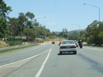
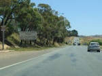
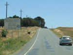
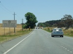
Statistics:

Length:
14 km (ACT sections only)
Termini:
Eastern: NSW-ACT Border
Western: Interchange with Monaro Hwy (NR23 / ALT-NR23) and Canberra Avenue (NR23) at Fyshwick
Miscellaneous:
Continued as Kings Highway (NR52) in New South Wales
Suburbs, Towns & Localities Along Route:
Fyshwick, Beard, Symonston, Harman and Kowen

Route Numbering:

Former: 52
Current: B52

NR52 was in two segments in the ACT, travelling just 5 kilometres from the junction with the Monaro Highway and Canberra Avenue at Fyshwick to the NSW-ACT Border at Beard. From the border it passes through several NSW towns including Queanbeyan, then back into the ACT for a few kilometres between Burbong, northeast of Queanbeyan, and the next NSW town of Bungendore.

The entire Canberra Avenue alignment is multi-lane dual carriageway. Canberra Avenue was known during the 1930s as Uriarra Road. 1

The route is the main road from the ACT to the NSW south coast, eventually connecting with the Princes Highway at Batemans Bay. It is one lane each way with occasional overtaking lanes throughout.

History:

20 September 1928: Canberra Avenue name gazetted 2
1974: National Route 52 introduced 3
30 July 1976: The first stage of the duplication of Canberra Avenue between Fyshwick and the NSW border opened to traffic. 4
9 May 1977: New route between Canberra and West Queanbeyan opened to traffic. It runs from the Queanbeyan side of HMAS Harman, crossed the Queanbeyan-Cooma Railway and joined with Kendall Avenue in Queanbeyan. 5
16 April 1982: The NSW section of Canberra Avenue, linking Canberra Avenue from Kendall Avenue to Monaro Street in Queanbeyan opened by the then NSW Commissioner for Roads, Mr Bruce Loder. 6
February 2011: Work commences on the Kings Highway southern deviation at Kowen between Queanbeyan and Bungendore. 7
April 2012: Kings Highway southern deviation completed. 7
November 2013: B52 appears on roadsigns around Kowen area.

Fyshwick To Kowen

image

Monaro Hwy Interchange:

Canberra Avenue (NR23) and Monaro Highway (NR23 / ALT-NR23) Interchange at Fyshwick, the western terminus of NR52. December 2009.

Image © Paul Rands

image

Monaro Hwy Interchange:

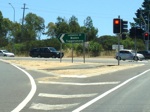
Intersection directional sign assembly on Ipswich St, Fyshwick at the interchange with Monaro Hwy (NR23) and Canberra Av (NR23 & NR52), January 2014. Note the missing NR52 shield.

Image © Paul Rands

image

Advance Directional Sign:

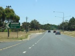
AD sign at Fyshwick approaching Hindmarsh Drive & Newcastle Street. December 2009. Note the missing NR52 shield.

Image © Paul Rands

image

Intersection Directional Sign:

ID sign at the Hindmarsh Dr & Newcastle St intersection in Fyshwick. December 2009.

Image © Paul Rands

image

Intersection Directional Sign:

ID sign at the Hindmarsh Dr & Newcastle St intersection in Fyshwick. December 2009.

Image © Paul Rands

image

Hindmarsh Drive & Newcastle Street Intersection:

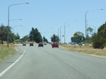
Eastbound as you approach the intersection with Hindmarsh Drive & Newcastle Street at Fyshwick. October 2004.

Image © Sam Laybutt (Ozroads)
image

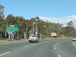
Intersection Directional Sign:

ID sign at the junction with Tom Price Street at Beard, November 2013.

Image © Paul Rands

image

Intersection Directional Sign:

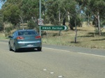
ID sign at the junction with HMAS Harman at Oaks Estate. December 2009.

Image © Paul Rands

image

Advance Directional Sign:

AD sign on Canberra Av approaching the interchange with Norse Road. December 2009. This was the only sign in this direction to show NR52.

Image © Paul Rands

image

Norse Road Interchange:

Canberra Av at the Norse Rd interchange at Beard, November 2013. Click or tap here for a photo of this location by Paul Rands from December 2009.

Image © Paul Rands
image

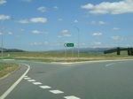
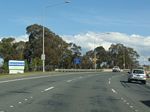
NSW Signs Inside ACT Border:

NSW signage on the ACT side of the border at Beard, November 2013.. Click or tap here for a photo of this location by Paul Rands from December 2009.

Image © Paul Rands

image

NSW-ACT Border:

NSW welcome sign as you cross over the border from the ACT. December 2009.

Image © Paul Rands

image

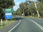
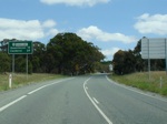
Re-entering ACT:

Border sign as you cross from NSW to ACT at Kowen. February 2010.

Image © Paul Rands

image

Policing Sign:

Australian Federal Police patrols sign as you cross from NSW to ACT at Kowen. February 2010.

Image © Paul Rands

image

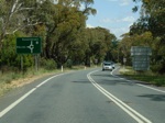
Advance Directional Sign:

AD sign at Kowen approaching the roundabout with the Australian Defence Force Headquarters Joint Operations Command (HQJOC) Facility. February 2010.

Image © Paul Rands

image

Supplemental Advance Directional Sign:

Supplemental AD sign at Kowen approaching the roundabout with the Australian Defence Force Headquarters Joint Operations Command (HQJOC) Facility. February 2010.

Image © Paul Rands

image

Intersection Directional Sign:

ID sign on the roundabout with the HQJOC Facility at Kowen. February 2010.

Image © Paul Rands

image

Distance Sign:

RD sign at Kowen after the HQJOC roundabout. February 2010.

Image © Paul Rands

image

NSW-ACT Border:

Kings Hwy as it re-enters New South Wales. February 2010

Image © Paul Rands

Kowen To Fyshwick

image

Policing Sign:

Australian Federal Police patrols sign as you cross from NSW to ACT at Kowen. February 2010.

Image © Paul Rands

image

Advance Directional Sign:

AD sign at Kowen approaching the roundabout with the Australian Defence Force Headquarters Joint Operations Command (HQJOC) Facility. February 2010.

Image © Paul Rands

image

Intersection Directional Sign:

ID sign on the roundabout with the HQJOC Facility at Kowen. February 2010.

Image © Paul Rands

image

Distance Sign:

RD sign at Kowen after the HQJOC roundabout. February 2010.

Image © Paul Rands

image

NSW-ACT Border:

Kings Hwy as it re-enters New South Wales. February 2010.

Image © Paul Rands

image

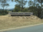
NSW-ACT Border:

ACT welcome sign as you cross over the border from NSW. December 2009.

Image © Paul Rands

image

Intersection Directional Sign:

ID sign at the junction with HMAS Harman at Harman. December 2009.

Image © Paul Rands

image

Australian Federal Police Sign:

Information on random breath testing and speed checks in the Australian Capital Territory. December 2009.

Image © Paul Rands

image

Welcome to Country Sign:

Sign welcoming visitors to Canberra, and also indicates the traditional owners of the land around the ACT area, Symonston, December 2009.

Image © Paul Rands

image

Urban Speed Limit Sign:

Sign at Symonston indicating the default urban speed limit in the ACT. December 2009.

Image © Paul Rands

image

Intersection Directional Sign:

ID sign at the junction with Tom Price Street at Symonston. April 2015.

Image © Paul Rands

image

Advance Directional Sign:

AD sign at Symonston approaching Hindmarsh Drive & Newcastle Street. April 2015

Image © Paul Rands

image

Advance Directional Sign:

AD sign at Symonston approaching Hindmarsh Drive & Newcastle Street. April 2015.

Image © Paul Rands

image

Intersection Directional Sign:

ID sign at the Hindmarsh Dr & Newcastle St intersection in Symonston. December 2009.

Image © Paul Rands

image

Intersection Directional Sign:

ID sign at the Hindmarsh Dr & Newcastle St intersection in Symonston. December 2009.

Image © Paul Rands

image

Suburb Name Sign:

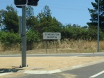
Typical later ACT suburb name sign, Symonston at the Hindmarsh Dr intersection. December 2009.

Image © Paul Rands

image

Intersection Directional Sign:

ID sign at the Faulding St intersection in Symonston. December 2009.

Image © Paul Rands

image

Monaro Hwy Interchange:

Canberra Avenue (NR23) and Monaro Highway (NR23 / ALT-NR23) Interchange at Fyshwick, the western terminus of NR52. December 2009.

Image © Paul Rands

image

Monaro Hwy Interchange:

Canberra Avenue (NR23) and Monaro Highway (NR23 / ALT-NR23) Interchange at Fyshwick, the western terminus of NR52. December 2009.

Image © Paul Rands

Click or tap here for the continuation of the route as Decommissioned NR52 in New South Wales
1 ACT Memorial, Stanley George Murray Gillespe
2 ACT Planning & Land Authority, Place Name Search, Canberra Avenue
3 Sam Laybutt (ozroads.com.au)
4 Canberra Times, Page 3, 30 July 1976
5 Canberra Times, Page 7, 6 May 1977
6 Canberra Times, Page 6, 16 April 1982
7 Hewatt Group, Completed Projects